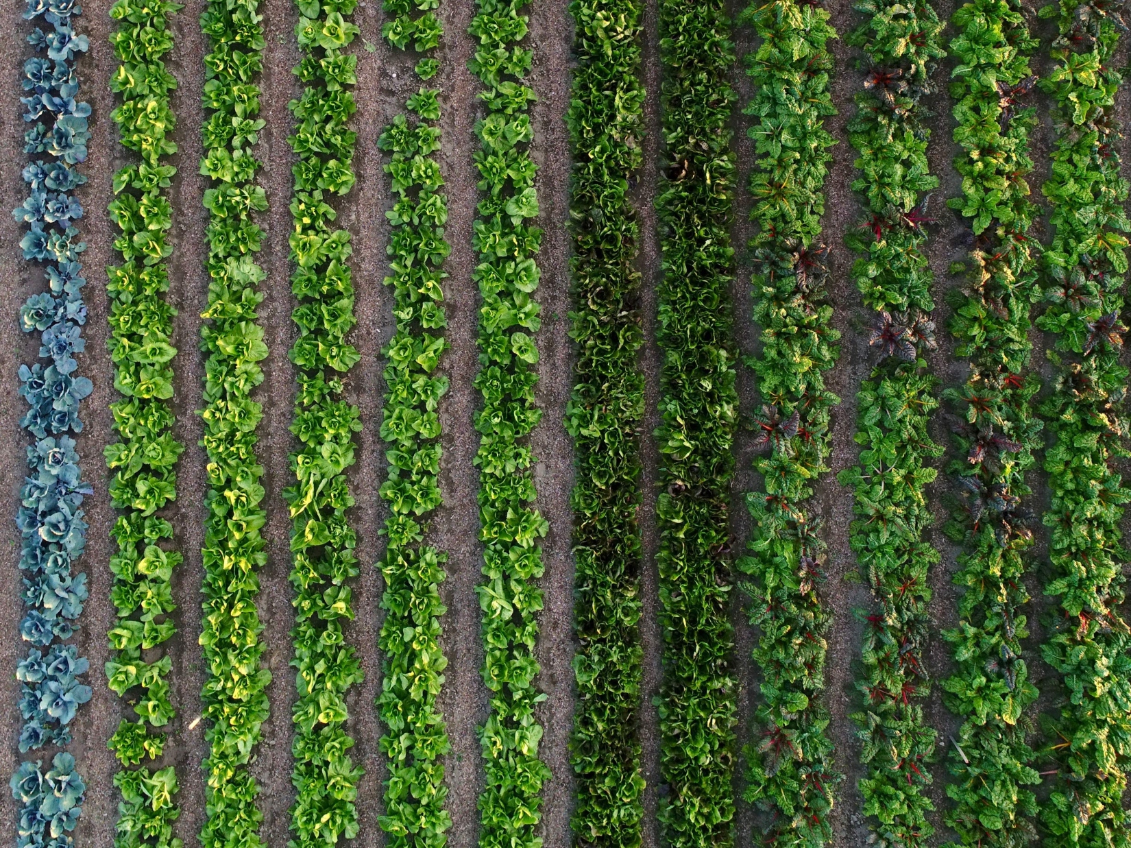
Market garden centres
Innovation to strengthen the Austrian fresh vegetable supply
Market garden centres work according to so-called bio-intensive methods. This means utilising the maximum possible natural yield potential on the land. This yield potential results from the respective location, the climatic conditions (temperature, precipitation, wind, etc.), the production methods and, to a large extent, the soil itself. Beside the type of soil and texture, the thickness of the individual soil layers, the condition of the soil in terms of soil fertility and soil health is of enormous importance for market gardeners. While the term soil fertility refers more to the function of productivity (mineral, physical and biological aspects), the term soil health is defined more systemically and expanded to include other soil functions. In addition to the productivity function, the water storage function, the habitat function for plants and soil organisms and their diversity, the nutrient management function and the climate function as a carbon store are relevant for market garden centres. In order to run a market garden successfully and sustainably, the soil condition in terms of its fertility and health must not only be maintained, but even improved in the course of cultivation. The goal in every market garden is therefore not only sustainable soil management, but also regenerative soil management. In this project, soil data such as aggregate stability, soil structure, temperature, moisture, infiltration, degree of mulch cover and compaction data are collected according to scientific principles. Data such as the degree of mulch coverage is collected directly from the gardeners, as we collect the data at 14-day intervals. The respective test facilities and test questions were customised together with the respective farm, as we attach great importance to practical questions.
For this project, participation is closed.
This project fulfils version 1.1 of the quality criteria for citizen science projects on Österreich forscht.
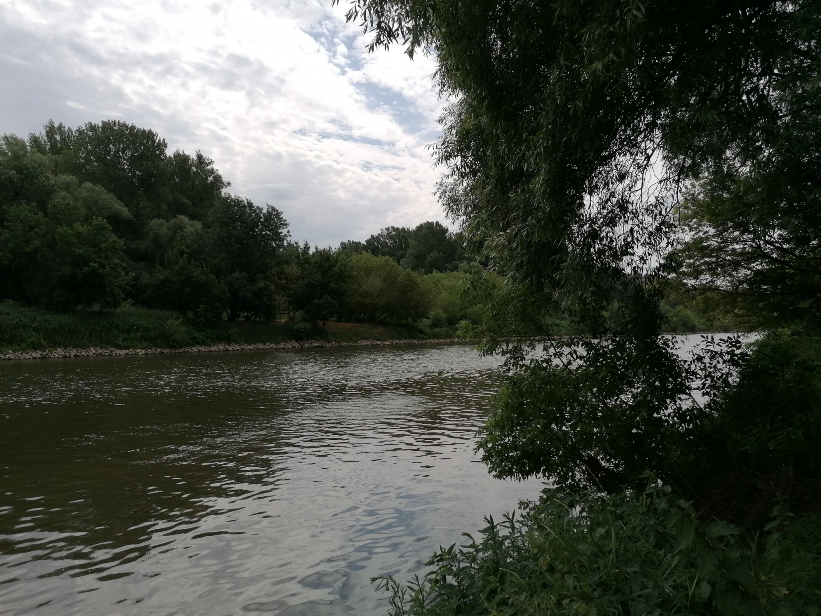
Restore4Life
What can we do to protect our wetlands and floodplains in Europe? What does the water management need to implement measure for the benefit of both the environment and the human society?
The Horizon Europe project Restore4Life aims at offering an online system that supports the restoration of wetlands in Europe. One important aspect is the development of easily applicable and meaningful methods to assess the state and functionality of wetlands before and after the restoration. This enables us to see whether the measures are sustainable for the future of the wetlands, for the climate and for us.
Why Citizen Science?
The integrity of wetlands can be assessed via a multitude of factors. Biodiversity indicates the health of the ecosystem, plant biomass shows how much carbon can be stored. In order to assess these data across Europe, we need methods which can be used also by non-experts. Together with Citizen Scientists, we want to develop, adapt, test, and optimize such methods so that we can offer them to other countries willing to implement restoration activities. We especially invite school classes to participate in our project.
The opportunities for joining the project are manifold: you can determine bird species via their songs, estimate the diameter and height of trees, evaluate orthophotos and satellite images, and many other things.
Where:
- March-Thaya-floodplains near Hohenau
- Salzach-Floodplains

This project fulfils version 1.1 of the quality criteria for citizen science projects on Österreich forscht.
U3Green
Promotion of child and youth-friendly urban landscapes through participatory research on urban green
The development of child- and youth-friendly cities is becoming increasingly important due to the deteriorating quality of life in urban areas. An important contribution to this relates to the provision of urban green suitable for young people and their involvement in the future design of urban landscapes. However, it must be taken into account that children and the youth make demands on urban green that are often not sufficiently known and which differ from what adults need and from what adults consider important for children and the youth. As a result, the participation of young people in the collection, evaluation and communication of what is important to them with regard to urban green plays an important role. But the involvement of young people in participatory initiatives is difficult, often falls short of expectations and is linked to various open questions, such as what are suitable tools and strategies to inspire and involve children and the youth in participatory initiatives.
With regard to these challenges, „u3Green“ pursues three goals:
- basic knowledge about the importance of urban green for children and the youth and how they actually use urban green will be gathered;
- a web-based, child and youth-centric application will be developed to collect, evaluate and share information on urban green;
- the results on the importance of urban green for children and the youth will be communicated using suitable geovisualization platforms such as interactive online maps and story maps.
Within the framework of various participation formats young people are involved in achieving the “u3Green” project goals using various methods (participatory design, participatory mapping, spatial data science, visual/ cartographic communication) and IT and geoinformatics tools (including ESRI applications). On the one hand, this refers to the participation of school students from the partner schools in workshops and spotlight events in order to discuss questions related to the challenges mentioned above and to develop initial solutions. On the other hand, school students from the partner schools contribute to the detailed answering of the questions within the framework of internships and workshop camps lasting several days.
Especially through the participation formats, "u3Green" supports the training of specialist knowledge and skills in the STEM field (i.e. teaching and study subjects relating to mathematics, computer science, natural sciences and technology) and other "soft skills" (e.g. science literacy) - in addition to an improved consideration of urban green spaces for young people in planning processes and an increased building of social awareness regarding urban green.
Co-operation partners: Österreichischer Dachverband für Geoinformation, Private Pädagogische Hochschule der Diözese Linz, Salzburger Institut für Raumordnung und Wohnen, Spatial Services GmbH;
Partners from Economy and Society: Naturpark Weißbach, Universität 55-PLUS, Paris Lodron Universität Salzburg, Wissensstadt Salzburg;
Participating schools: Akademisches Gymnasium Salzburg, ASO Stadt Salzburg, BG Zaunergasse, Salzburg, BORG Oberndorf, Holztechnikum Kuchl, Werkschulheim Felbertal; BG & BRG Keimgasse Mödling
Video
@projekt.u3green Wir brauchen deine Stimme! ☀️ #u3green #plus_1622 #fyp #foryoupage #fy ♬ clocks - -
u3Green is funded by the Federal Ministry of Education, Science and Research in the Sparkling Science 2.0 program
![]()
This project fulfils version 1.1 of the quality criteria for citizen science projects on Österreich forscht.
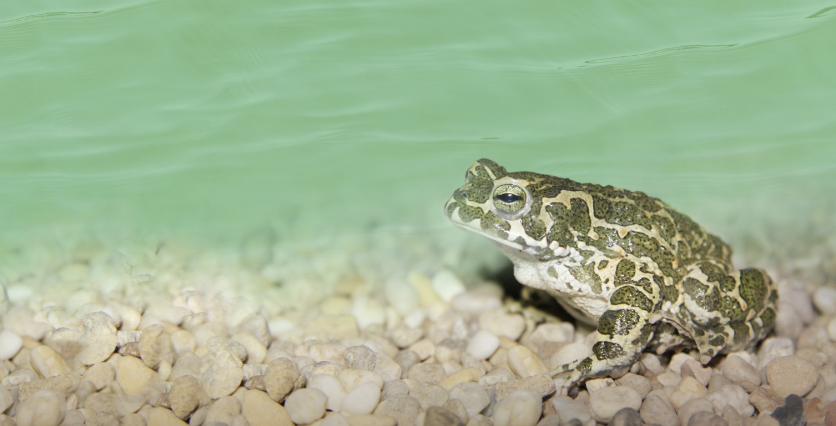
AmphiBiom
The AmphiBiom project is focused on the study of the European green toad in Austria. With the support of Citizen Scientists, we investigate the distribution of this endangered amphibian species, which, as a typical pioneer species, can quickly colonize newly emerging water bodies.
Therefore, the European green toad is an ideal species for projects to investigate the distribution status through call monitoring and the installation of small water bodies with the support of the Citizen Science Community. With AmphiBiom we want to show that everyone can support the survival of this protected species with just a little effort. Already through these small but valuable measures, the general awareness that is needed to better understand species and habitat protection measures, is strengthened.
Project background
Amphibians are among the most threatened animal taxa in Austria and worldwide. The reasons for this include habitat destruction and degradation, fungal diseases, and changes in land use. For some amphibian species, despite many disturbances, agricultural areas or even cities also represent important habitats. The natural spawning grounds of the European green toad, are steppe lakes filled after rainfall or ponds formed after flooding with strong sunlight. With a few exceptions, the natural spawning habitats of the European green toad have largely disappeared in Europe. In addition to these near-natural water bodies, artificial water bodies or puddles filled after rain showers are often accepted by European green toads today.
The importance of alternative habitats
The disappearance of fallow land and closure of gaps between buildings, leads to a deterioration of the conservation status of the green toad in rural areas as well as in inner-city areas. Countermeasures, such as the provision of replacement habitats, can prevent this negative development. The initiative for the creation of small water bodies, which is scientifically accompanied in the AmphiBiom project, not only forms an additional spawning offer for green toads and other threatened amphibians (e.g., Yellow-bellied toad). It gives us the opportunity to study the succession and progressive colonization of water bodies by diverse pioneer fauna.
The contribution of AmphiBiom to the conservation of the green toad
This project uses Citizen Science to study this pioneer species in order to investigate its distribution in areas that are often inaccessible for research (e.g., private gardens) and to actively involve citizens in the project.
In addition to creating new habitats for the green toad and other amphibians, we are also using the power of citizen science to launch an Austria-wide, app-based amphibian call monitoring programme. With its high-pitched warbling, the green toad is certainly one of the most beautiful calling amphibians in Austria, but it is not the only one with a characteristic song. For example, tree frogs and toads can also be clearly identified by their song. As part of the AmphiBiom project, we invite interested people to use our mobile phone app "AmphiApp" to record amphibian calls in their neighbourhood and thus contribute to the knowledge about the distribution of these protected animals.
In a further step, the complementary evaluation of already existing protection measures will clarify in which areas such measures (still) make sense, or where they could contribute to the resurgence of populations classified as extinct.
Podcast episode
If you would like to learn more, you can listen to the Wissen macht Leute podcast episode about the project (in German). More information can be found here.
Citizen Science Seminar
In autumn 2024, poject coordinator Lukas Landler held a lecture about AmphiBiom as part of the lecture series "Citizen Science Seminar" at BOKU University: The citizen science project "AmphiBiom - habitat for green toads and co" (in German).
Dieses Projekt wird durch den Biodiversitätsfonds des Bundesministeriums für Klimaschutz, Umwelt, Energie, Mobilität, Innovation und Technologie gefördert.
![]()
This project fulfils version 1.1 of the quality criteria for citizen science projects on Österreich forscht.
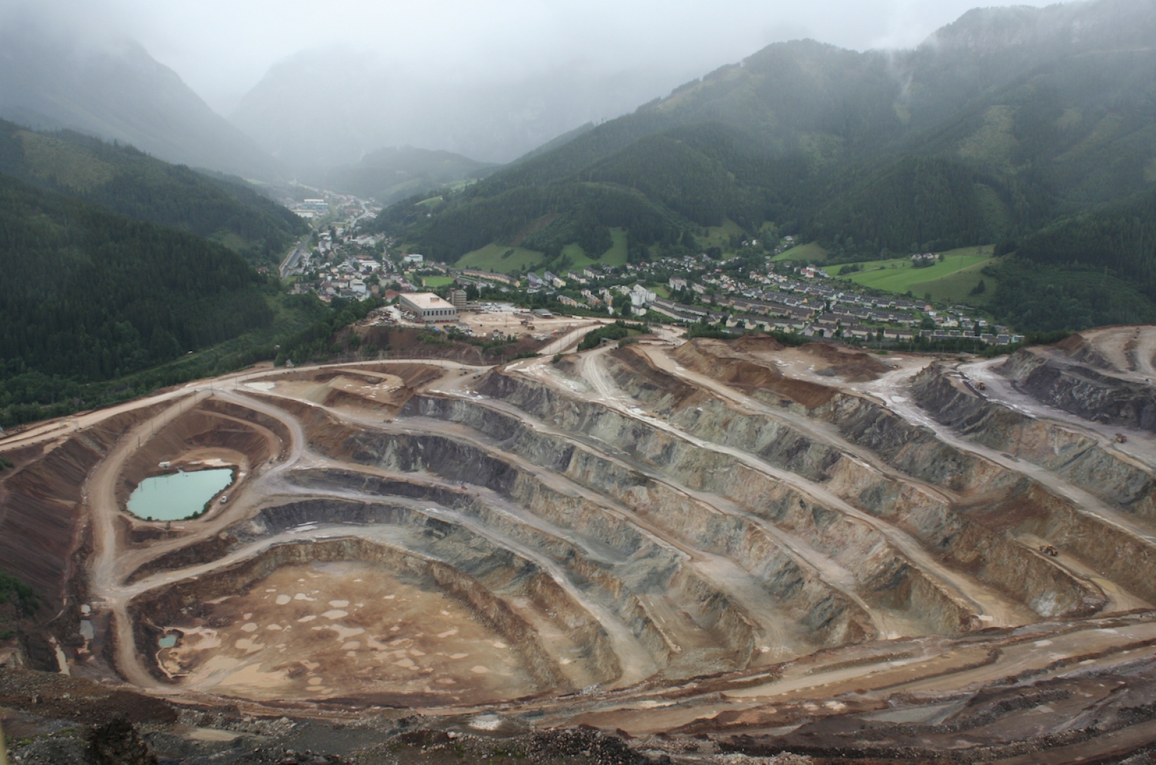
Stories of Post-extractive F*utures
The shrinking town of Eisenerz lies at the foot of the Erzberg mountain, Austria’s largest and best-known site of extraction of iron ore. The post-industrial town is experiencing a rural exodus, which concerns women in particular. The spatial practices of mining areas have been under-researched using inclusive methods. Mining is predominantly narrated in male, heroic narratives, while counter-narratives of repair, care, reproduction and maintenance are mostly overlooked.
Within this complex field, the project focuses on intersectional feminist perspectives on an area of exhaustion; it will collect feminist post-extractive stories to broaden the perception of mining areas and strengthen the focus on feminist narrations for future perspectives. We ask: Which practices contribute to the continuance of the community? The project shows and discusses the spatial practices of repair amid extraction with multiple actors. We work with local associations to reach diverse groups.
Thinking and knowing with the diverse, often surprising, actors and their practices, the citizen scientists shape the project on several levels: they collect and locate stories of practices, they research private archives, and they report and sometimes even organize. Processes of mutual learning take place in meetings and shared activities, and through the process of transformation into drawings by the East Styrian artist Roswitha Weingrill. Based on collaborative science and an affirmative and inclusive approach, citizens are involved in decisions on many levels, especially concerning their contributions and their representation. The collected knowledge will contribute to creating imaginations of future stories of a liveable community. With the help of artistic methods, these will be illustrated and made accessible in public discussions.
Via strategies of making visible, bringing together, and anticipating and activating futures, and also with the help of artistic tools of knowledge production, this project will show practices as constant reparative counter-practices amid extraction. An ethical, intersectional framework of feminist citizen science will revive the margins of how we know about environmental exploitation to deliver a complex, yet profound, image of a polyphonic Anthropocene that allows for imagining dynamic assemblages after exploitation.
Photo gallery


https://www.citizen-science.at/en/component/k2/tag/land%20use?start=10#sigProId50bd6c7cc8
![]()
![]()
This project fulfilled version 1.1 of the quality criteria for citizen science projects on Österreich forscht.
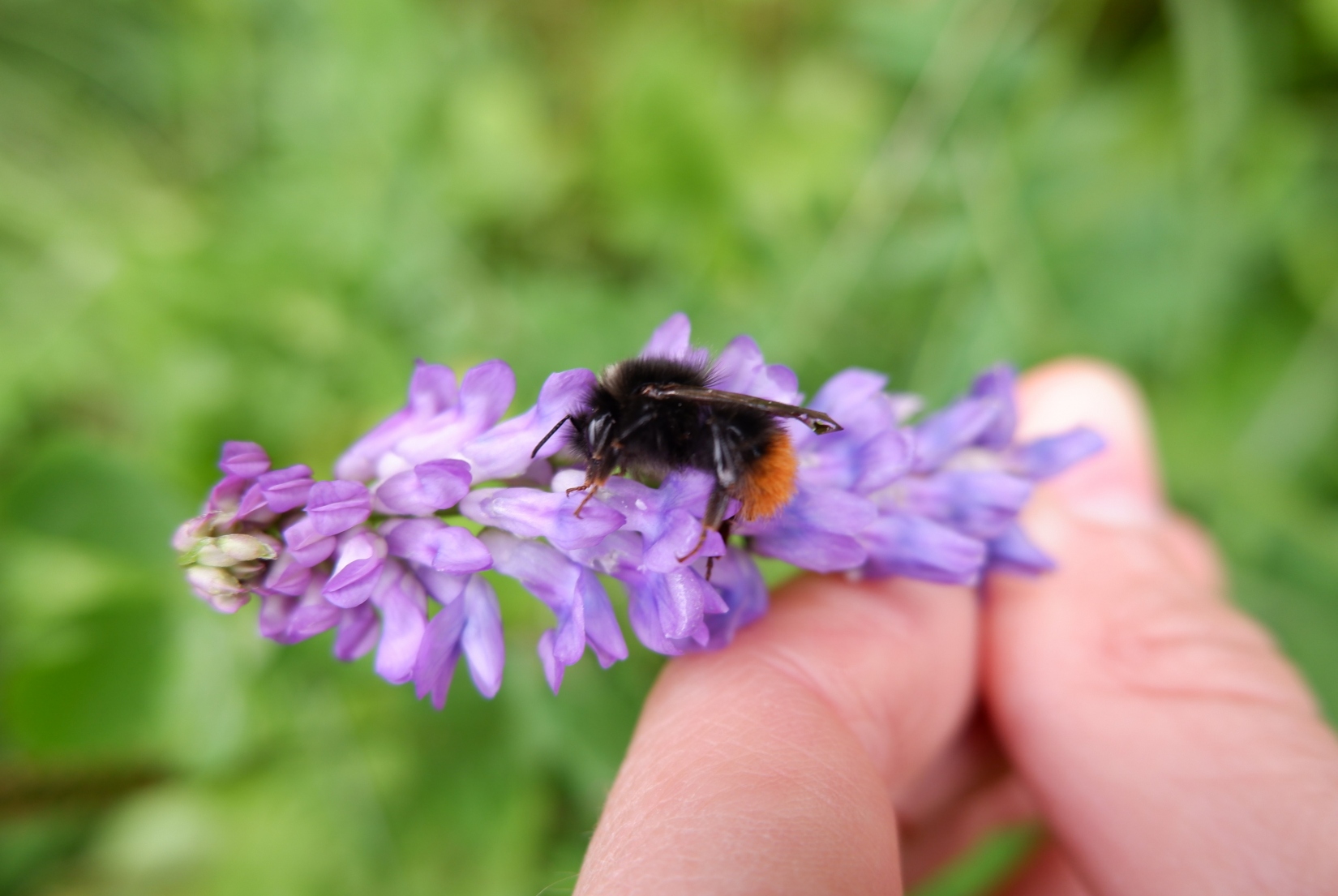
Bumblebee Monitoring Austria
Citizen science-based bumblebee monitoring is a pillar of the Austrian wild bee survey. Most wild bee species can only be distinguished under a microscope. The genus of bumblebees (Bombus) is an exception and can usually be distinguished at species level after a training phase in the field (see Gokcezade et al., 2010), so that not only professionals can help with the observation and recording of bumblebees. Bumblebee monitoring ties in with the already existing reporting platform "naturbeobachtung.at" of the Austrian Society for Nature Conservation.
Through numerous initiatives such as bumblebee identification courses and excursion offers, a citizen science community with very good expertise has been formed in recent years. Since 2014, more than 61,000 observations of all bumblebee species currently occurring in Austria have been reported by over 700 reporters via web and app. In 2021 alone, 12,600 bumblebee observations were received. More than 51,000 reports could be checked, corrected if necessary and confirmed by professionals. Within the framework of the project, the reporting platform is to be expanded to include the option of transect counting (previously non-standardised individual observations) and interested participants are to be motivated, trained and supported.
The aim is to develop a functioning citizen science network in the next two years, which will be used in the long term. We aim to cooperate with other European countries that have established similar projects in order to address the ongoing biodiversity crisis on an international level. In the future, trends for individual populations are to be derived from the data and conservation measures improved.
This project fulfils version 1.1 of the quality criteria for citizen science projects on Österreich forscht.
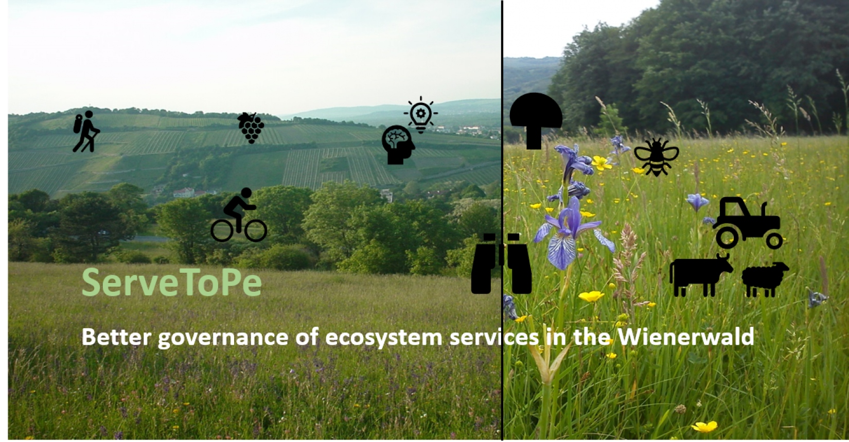
ServeToPe
Better governance of ecosystem services at local scales in the Wienerwald region
A joint research project of the University of Natural Resources and Life Sciences, Vienna (BOKU) and the University of Vienna.
What is ServeToPe studying and what are its goals?
Society uses a variety of services that natural ecosystems provide, such as clean water, an attractive landscape for recreational purposes, food, or renewable energy sources. Many of these so-called ecosystem services (ESS) are influenced by humans. These include, for example, agricultural activities or the construction of roads. As a consequence, society regulates human actions and thus indirectly the availability of ESS. Examples of such policies are agri-environmental programs or local land use planning.
The Citizen Science project ServeToPe develops methods to better quantify the demand for ESS and their availability in a landscape. ServeToPe thus aims to contribute to more sustainable management of ESS and more targeted policies that focus on people's needs. ServeToPe is thereby based in the biosphere reserve Wienerwald as a case study region.
ServeToPe mainly aims to answer the following research questions.
- What is the current demand for ESS and to what extent can the Wienerwald region satisfy this demand with the offered ESS?
- What does "good management" mean from the citizens' point of view? How can policies contribute to a convergence of demand for ESS and their supply?
ServeToPe will reveal mismatches between the demand for ESS and their supply and will propose countermeasures. An example of this could be regional conservation efforts specifically planned for the landscape.
What methods are used?
ServeToPe uses a variety of methods to answer the research questions and to involve as many and as diverse citizens as possible. For example, workshops were held in schools or with citizens from the region. All citizens can participate online via a survey (see below). On the project website you can find more information about the methods and the roles of citizens (in German).
How can I participate?
Citizens are important research partners in ServeToPe. In particular, they support the visualization and quantification of the demand for ESS and of conflicting goals and trade-offs of between different ESS. A trade-off exists, for example, when several citizens want to use the same area for different purposes resulting in conflicts (e.g. recreational use and food production). You as citizen can therefore make an important contribution to the research project by participating in the following anonymous surveys.
In the main survey you can (1) enter your own activities and uses of ESS in the Wienerwald, (2) enter and locate frequently observed activities and ESS uses, and (3) identify trade-offs and opportunities for improvement. You can also upload pictures for this purpose. The main survey can be filled in only once.
However, you can also participate more regularly and thereby support ServeToPe even more intensively. This is possible via a second short survey, where you can enter and locate observed activities and ESS uses, as well as trade-offs. A picture upload is also possible here. In this short second survey, you can participate repeatedly over the entire duration of the project - i.e. continuously enter your observations. This gives us an even more accurate representation of uses and activities. You as a citizen scientist gain the opportunity to locate multiple uses and activities in areas and therefore identify multiple and more accurate trade-offs and improvements.
What happens to these results?
The results from the surveys of activities, uses, and trade-offs in the Wienerwald are compiled by the BOKU Vienna and University of Vienna research team and compared with other data on the supply of ESS (see methodology). These results are then published on the ServeToPe website. You can also sign up in our contact form to receive the results via email.
Afterwards, the results are presented to stakeholders from the region (e.g.: Employees of the administration, representatives from agriculture, nature conservation, recreational use, education and regional management) in a workshop. In this workshop, solutions and countermeasures will be developed based on the identified trade-offs and conflicts due to differences in ESS supply and demand.
If you have any questions, please contact Katrin Karner (This email address is being protected from spambots. You need JavaScript enabled to view it.) without hesitation.
The project team
ServeToPe is led by Martin Schönhart (This email address is being protected from spambots. You need JavaScript enabled to view it.) and Katrin Karner (This email address is being protected from spambots. You need JavaScript enabled to view it.), from the Institute for Sustainable Economic Development at BOKU University. Furthermore, the project team includes Thomas Wrbka (This email address is being protected from spambots. You need JavaScript enabled to view it.) and Florian Danzinger (This email address is being protected from spambots. You need JavaScript enabled to view it.) from the Department of Botany and Biodiversity Research at the University of Vienna. In addition, the students of the course " Conservation Related Methodologies of Social, Cultural and Economic Sciences" of the University of Vienna are involved in the project. If you have any questions, please contact Katrin Karner (This email address is being protected from spambots. You need JavaScript enabled to view it.) without hesitation.
![]()
![]()
![]()
This project fulfils version 1.1 of the quality criteria for citizen science projects on Österreich forscht.
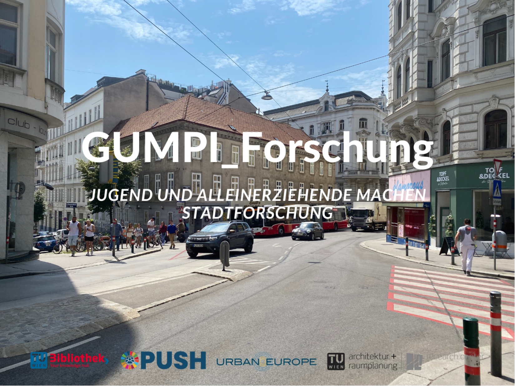
GUMPI
Youth and single parents doing urban research
About the project
The climate crisis repeatedly exposes existing weaknesses in democratic practice. On the one hand, groups that are most affected by the consequences of climate change are often underrepresented in the prevailing political and planning practice (participation crisis). On the other hand, social inequality and the exclusion of people from political decision-making processes increases the loss of trust in political decision-makers and institutions (democracy crisis). Therefore, dealing with the consequences of the climate crisis in research and planning cannot be done without looking at ecological and social justice. Who can have a say in crises and help develop solutions? Who suffers most from the consequences of the crises and who does urban development reach?
What is the aim of the project?
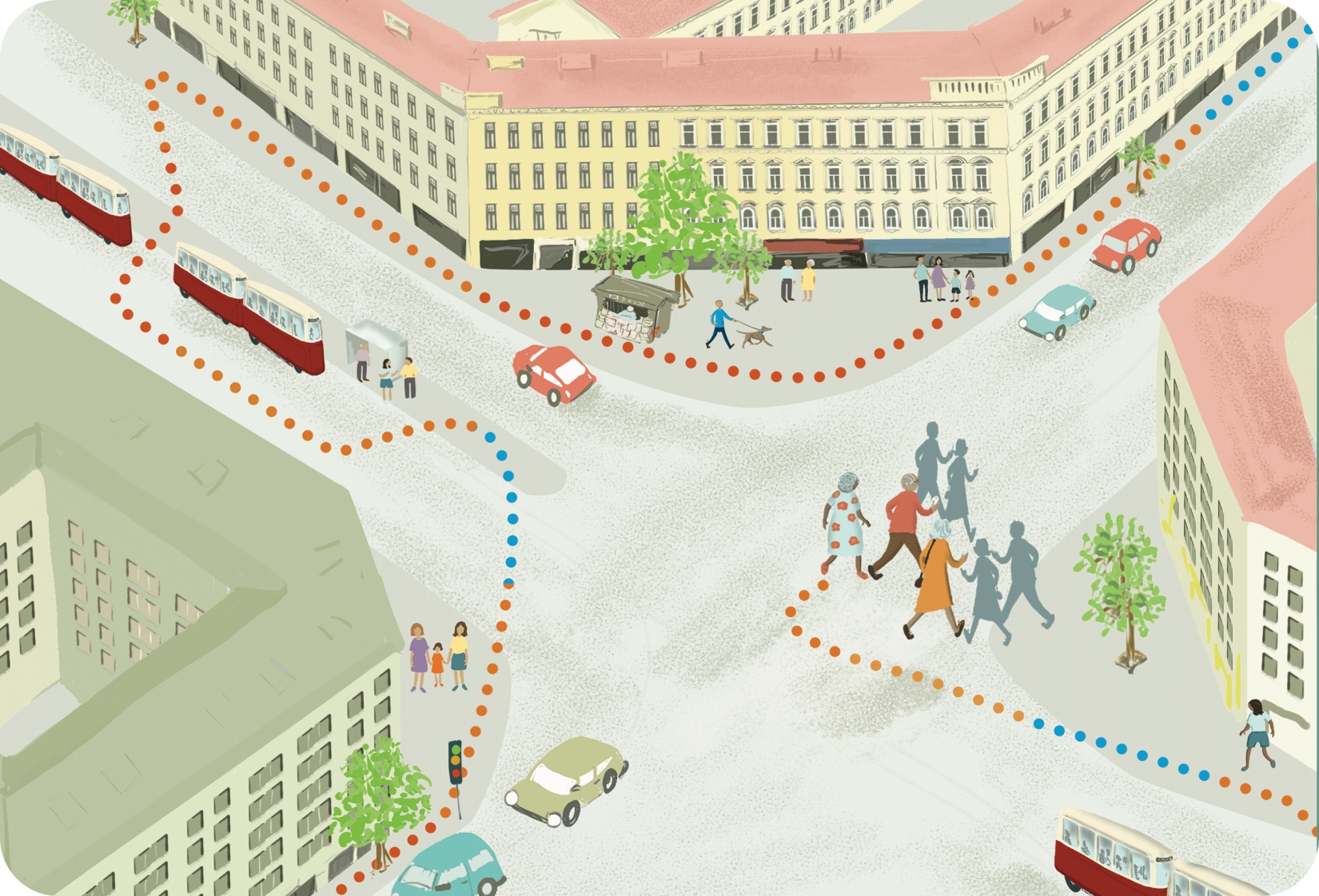
The project aims to explore possible applications of Citizen Social Science (CSS) in urban development, especially regarding the potential of involving usually underrepresented groups. The central research interest is to identify to what extent CSS can complement transformation processes, such as the redesign of a street space in an urban context, with the perspectives of marginalized groups. For this purpose, two Citizen Science experiments will be conducted with two selected groups using the participation process "zukunftsfitte Gumpendorfer Straße" in Vienna's 6th district: Single parents and students. The results of these CSS Experiments will help to understand how vulnerable groups can be better represented in transformation processes of urban development leading to environmental and social justice.
What happens with the results?
The project is gathering experience on how to involve marginalized groups in urban development transformation processes through CSS activities. Based on this experience, recommendations for the implementation of CSS in urban development will be developed regarding process design and application of methods.
Based on the perspectives of two marginalized groups, complementary knowledge bases are generated for the transformation of the Gumpendorfer Straße. This knowledge will be handed over to the planning office PlanSinn, which is implementing the participation process for the redesign of Gumpendorfer Straße in a bidding consortium with CarlaLo on behalf of the district.
How can I participate?
The project structure is divided into two dialog groups: single parents and students. The participation for the group of single parents is open to single parents in Vienna who regularly visit the area of Gumpendorfer Straße. Participation is possible at our website.
The group of students will be approached directly by the project team through interested teachers at different schools in Mariahilf. Information on the progress of the project will be published on the website of the TU Wien Library.
Who is behind the project?
The project part on the group of single parents is led by Tamara Bauer, who is currently writing her diploma thesis at the future.lab Research Center of the Vienna University of Technology.
The project part on the group of students is led by Sebastian Harnacker, project staff member at the TU Wien Library. The project will be carried out in cooperation with partners from the participation and transformation process.
The project is part of the research project "OPUSH" at the TU Wien. The aim of the international research project "OPUSH" is to make knowledge about sustainable development visible and accessible to local communities. Project partners from the four European cities of Barcelona, Delft, Tallinn and Vienna are conducting research together with citizens; libraries and other local cultural institutions are playing a mediating role.

![]()
![]()
![]()
This project fulfilled version 1.1 of the quality criteria for citizen science projects on Österreich forscht.
Urban Heat Stories
What are Urban Heat Stories?
It will get hotter and hotter in the city over the next few years. The impact of heat can vary greatly from neighborhood to neighborhood. It depends not only on the building density or the degree of sealing in the city, but also on the age and state of health of the people and their immediate living environment.
The Urban Heat Stories research project therefore collects individual heat experiences of vulnerable groups in Vienna. The aim is to make the diverse concerns and demands of city dwellers visible.
The aim is also to develop a chatbot pilot. It should provide insights into the social dimension of heat at city level. On this basis, recommendations for sustainable urban development in the face of rising temperatures can be expanded to include a social dimension, thus integrating the needs of vulnerable groups into planning in the long term
How does Urban Heat Stories work?
The main cooperation partners are the city's residents. In a two-part workshop, they first map their locations in the public space around their homes. The temperatures of the localized places are investigated using mobile sensors in a joint perceptual and exploratory walk. The measured temperatures are compared with the personal perception of heat. This provides a basis for discussion of the Urban Heat Stories. These stories are the foundation for the development of the new chatbot pilot on heat perception in the city.
How can I participate in the research?
Starting in September 2023, four workshops with senior citizens as Citizen Scientists have taken place around Quellenplatz (10th district, Vienna). The format is to be continued in spring/summer 2024 in other districts with other target groups. A first chatbot pilot will additionally be launched in winter 2024.
Upcoming events:
- Urban Heat Stories at the Citizen Science Day at the Natural History Museum Vienna: As part of the Citizen Science Day (06.04.2024, NHM Vienna), interested citizens will have the opportunity to learn about the project, share their own stories and measure temperatures with us. We are looking forward to your visit!
- Citizen Science Award 2024: We are delighted to have been selected as one of eight projects for the Citizen Science Award 2024. Workshops with schools will take place between April and July 2024. Details on how to register at: www.youngscience.at/csa.
If you are interested in conducting a Citizen Science research on heat experiences (e.g. workshop participation, chatbot test) in your neighborhood, we would also be pleased to receive a short initiative mail.
Podcast episode
As part of the episode "The Citizen Science Award 2024 - behind the scenes", Sebastian Harnacker presented the project in the podcast Wissen macht Leute. You can listen to the episode on our blog or on the podcast app of your choice (the episode is in German). You can find all the details here.
Blog Post on the Award-Winning Completion of the Project
The project 'OPUSH – Citizen Science Pilot Urban Heat Stories' was honored with the "CliA – Österreichischer Staatspreis für Klimawandelanpassung": https://www.citizen-science.at/blog/tu-wien-gewinnt-oesterreichischen-staatspreis-fuer-klimawandelanpassung-clia (Blogpost in German)
What happens with the results?
The findings will provide the basis for recommendations in urban planning and will be incorporated into current Viennese planning projects (e.g. WienNeu+, 10th district). They will also be published on the website of the future.lab Research Center of TU Wien. For participants - as co-researchers - the results will also be made available free of charge as a print edition.
Who is responsible for the project?
The project team consists of researchers from the future.lab Research Center and TU Wien Bibliothek as well as residents as citizen scientists. Urban research does not take place in a laboratory, but together on site. Residents contribute their experiences and interests.
The project is being implemented - as part of the European research project "OPUSH" - in close cooperation with the partner project Heat Chronicles (Cròniques de la Calor) of Open Systems at the Universidad de Barcelona. There is cooperation at local level with the City of Vienna (MA 22, MA 25, GB*), the Vienna Chamber of Labor and the Natural History Museum.
What roles are there in the project?
- The transdisciplinary project team is made up of the research group of the future.lab Research Center and the TU Wien Bibliothek. The TU Wien Bibliothek can draw on experience in the fields of big data and urban heat, among others.
- The residents participate as citizen scientists in the development of content for the Chatbot and are central to the collection of data in the form of micro-stories.
- The Natural History Museum is involved as a local stakeholder with extensive experience with citizen science experiments.
- Local project partners are also the municipal departments of the City of Vienna MA 21 and MA 22 (expertise and meteorological background data), the Vienna Chamber of Labour (e.g. social space monitor), OpenKnowledgeMaps (data visualization) and Wunderbyte (chatbot programming).
![]()
![]()
![]()
This project fulfils version 1.1 of the quality criteria for citizen science projects on Österreich forscht.
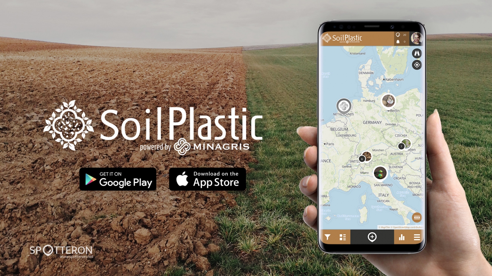
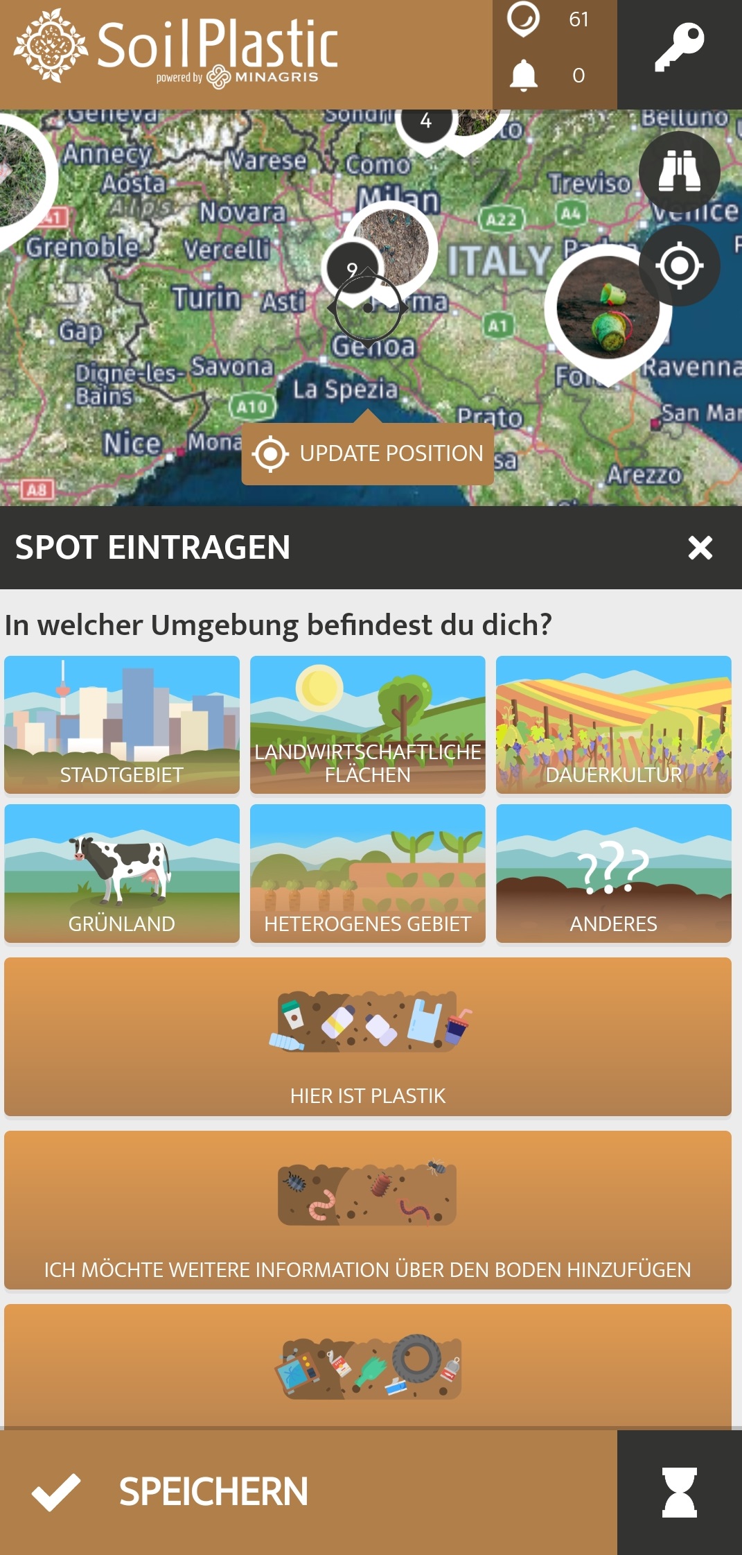
SoilPlastic
SoilPlastic is a citizen science project that collects data on plastic in soils. No prior knowledge is needed to participate and you can enter your observations in the SoilPlastic app in just a few minutes.
What is it about?
Plastic products and their remains are ubiquitous. However, we still know little about how much and which types of plastic end up in soils and what effects this has. Observations by citizen scientists help scientists to fill this knowledge gap. This is an important field of (citizen) science, as we rely on soils to produce 95% of our food.
How can you participate?
With the SoilPlastic app for Android and iOS, observations can be entered anywhere and at any time. Entries can also be made via the browser in the web-based app. So if you spot plastic in the environment while walking, cycling or on your way to work/school, enter your observation as a "spot" in the app. GPS localisation on your smartphone should be activated so that the spot is automatically placed in the right location. A spot needs at least information about the amount and size of the plastic found, about the surroundings (field, park, etc.) and a photo of your observation.
Other details are optional: colour of the plastic, type of plastic, information about the soil (texture, soil life), other material found. This will help the research team to understand the distribution of plastic and the site more precisely. Of course, the environment will be happy if you take the found objects with you and dispose of them in the correct waste bin.
What do I get out of it as a citizen scientist?
The citizen scientists become part of the EU research project MINAGRIS (Micro- and Nanoplastics in Agricultural Soils) and make an important contribution to a clean environment by adding knowledge and collecting the found objects from the environment and disposing of them properly. You will also learn new things about plastics, soil and (citizen) science in a fun way. Furthermore, the SoilPlastic app allows you to connect with other Citizen Scientsts who probably have similar interests. As the SoilPlastic app is part of the citizen science platform Spotteron, you can use the same account as in other Spotteron apps and communicate about different topics and projects.
What is the data used for?
The collected data is used in the MINAGRIS project to get an overview of the amount and type of visible plastic on soils. MINAGRIS investigates the effects of plastic on soils and biodiversity and develops a sustainable use of plastic. The spots in the SoilPlastic app are also visible to everybody interested.
Interactive map:
Links:
Zoom into Soil: Microplastics: Webinar of the British Society of Soil Science about microplastic in soils
MINAGRIS is funded by the European Union's Horizon2020 programme for research and innovation under contract number 101000407.
Picture gallery


https://www.citizen-science.at/en/component/k2/tag/land%20use?start=10#sigProId9c4b79d76d
Development of the app by Spotteron
![]()
SoilPlastic is part of the EU project MINAGRIS
![]()
This project fulfils version 1.1 of the quality criteria for citizen science projects on Österreich forscht.