Tree-Quest
The Tree-Quest project aims at developing an Austrian citizen science (CS) data component to bridge the in-situ data gap for more reliable forest mapping with Copernicus satellite data.
What are the aims of the project?
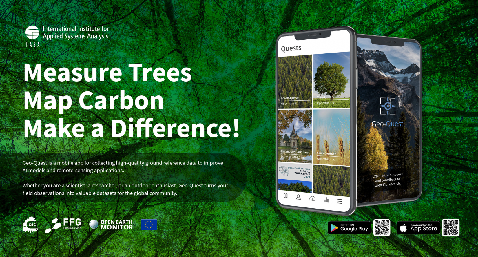
We’re inviting everyone to join our new citizen science campaign through the free Geo-Quest app. Using the Tree-Quest module, you can head outside and measure trees in your neighborhood — and discover how much carbon they store! You’ll learn how trees help fight climate change and see how many trees it takes to balance out the carbon emissions from things like driving or flying. The data you collect will also support scientists in creating better maps of carbon stored in forests, using satellite images from space.
How can you participate in the research?
How to Join the Tree Quest Carbon Campaign: Simple Steps
- Download the Geo-Quest app - Get the free app on your smartphone from the App Store or Google Play.
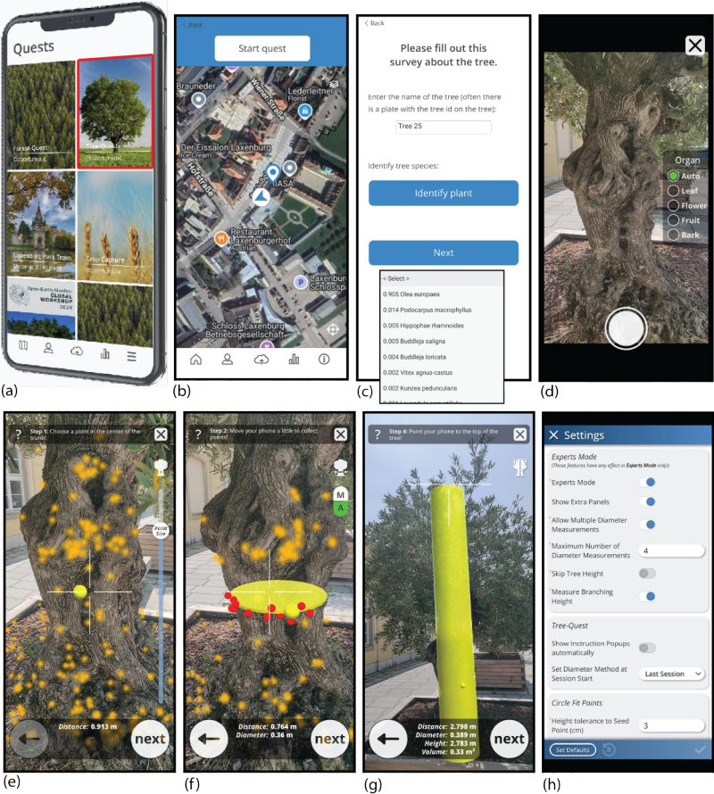
- Open the Tree-Quest module Launch the app and select the Tree-Quest feature to start measuring trees.
- Find a tree near you - Head outside and pick a tree in your neighborhood, park, or nearby green space.
- Measure the tree - Use the app to measure the tree’s diameter and height. Identify the tree species if you can.
- Submit your data - Enter the measurements into the app and send your data to help scientists.
- Repeat and explore -Measure more trees around you to contribute even more valuable information
- Share your impact -Tell friends and family about the campaign and encourage them to join!
![]()
- land use
- plants