DANUBE4all
DANUBE4all is an EU project with the main task of developing a comprehensive action plan for the renaturation of river stretches in the Danube River Basin (DRB). To this end, a collaborative stakeholder process is being developed that actively incorporates the interests of citizens. The action plan is intended to contribute to the improvement of the ecological status, biodiversity and river connectivity of the Danube ecosystems and thus supports the EU mission OCEAN ‘Mission Healthy Oceans, Seas, Coastal and Inland Waters’.
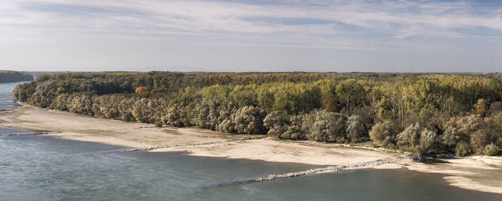
The development and implementation of innovative and socially relevant nature-based solutions has a wide range of positive effects. In addition to the improved connectivity of rivers, possible scenarios for floodplains, reducing the risk of floods and droughts, and other socio-economically effective measures are an important focus. Renaturation projects on the Danube are being promoted with the goal of improving the continuity of sediments and positively influencing habitats/biota. These include the Danube National Park east of Vienna, a section of the river in Hungary and a measure on the Danube delta.
Nature-based solutions must be developed in collaboration with the affected population and supported by them in order to be effective in the long term. Renaturation processes tend to unfold slowly and require continuous attention and active support in order to be successful. Accordingly, the intensive involvement of citizens along the Danube is an important component that makes renaturation possible in the first place. A special work package supports interaction with citizens through the activation of citizen science. Citizen scientists are particularly involved in the development, implementation, evaluation and scaling of nature-based solutions, a citizen science method toolbox, and the development of communication measures.
In particular, DANUBE4all serves the following research fields:
- Criteria and indicators for physical connectivity status as a starting point for renaturation options in the Danube catchment. A reflection of existing assessment methods and initiatives contributes to this.
- Analysing the (ecological) status of water bodies and biodiversity with the aim of expanding the existing transnational biodiversity monitoring with a strong focus on restoration. This includes long-term trends in connection with management and conservation measures associated with renaturation.
- Co-creation, implementation and results monitoring of nature-based solutions implemented in the project in the Danube River Basin. This includes:
- 3 restoration interventions with the participation of local residents (3 Demonstration Sites);
- the further use and replication of solutions in 5 Associated Regions;
- later a multiplication of the approach by supporting 10 restoration measures (10 Synergy Sites).
- Implementation of socially relevant integrative measures with municipalities in the Danube River Basin. This includes measures that trigger social and economic change, as well as the sustainable, integrative and long-term management of restored ecosystems through public mobilisation and engagement. This is also to be achieved through citizen science.
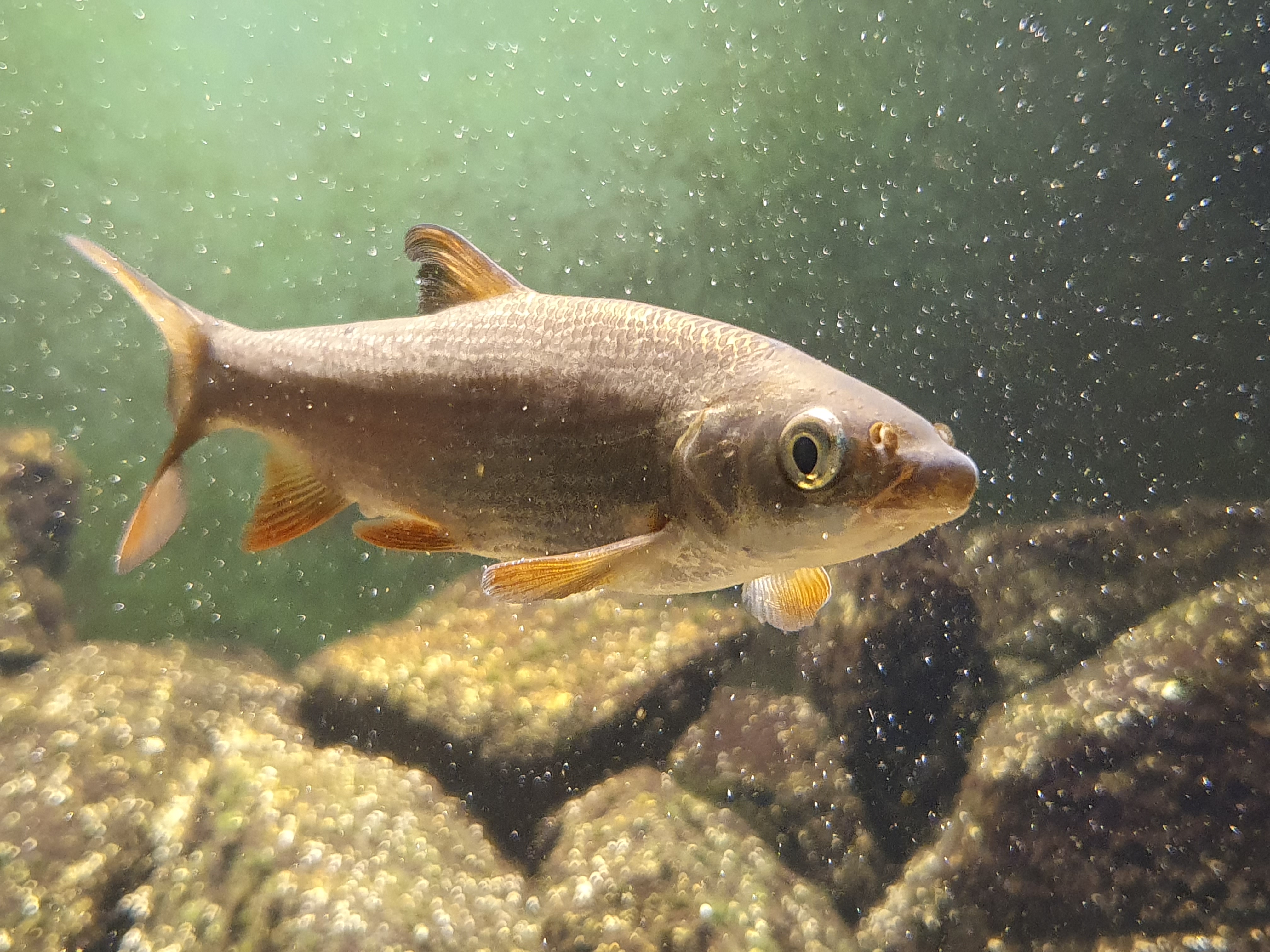
common nase, © Robert Togel (Images courtesy of viadonau)
This project fulfils version 1.1 of the quality criteria for citizen science projects on Österreich forscht.
On the trail of springs
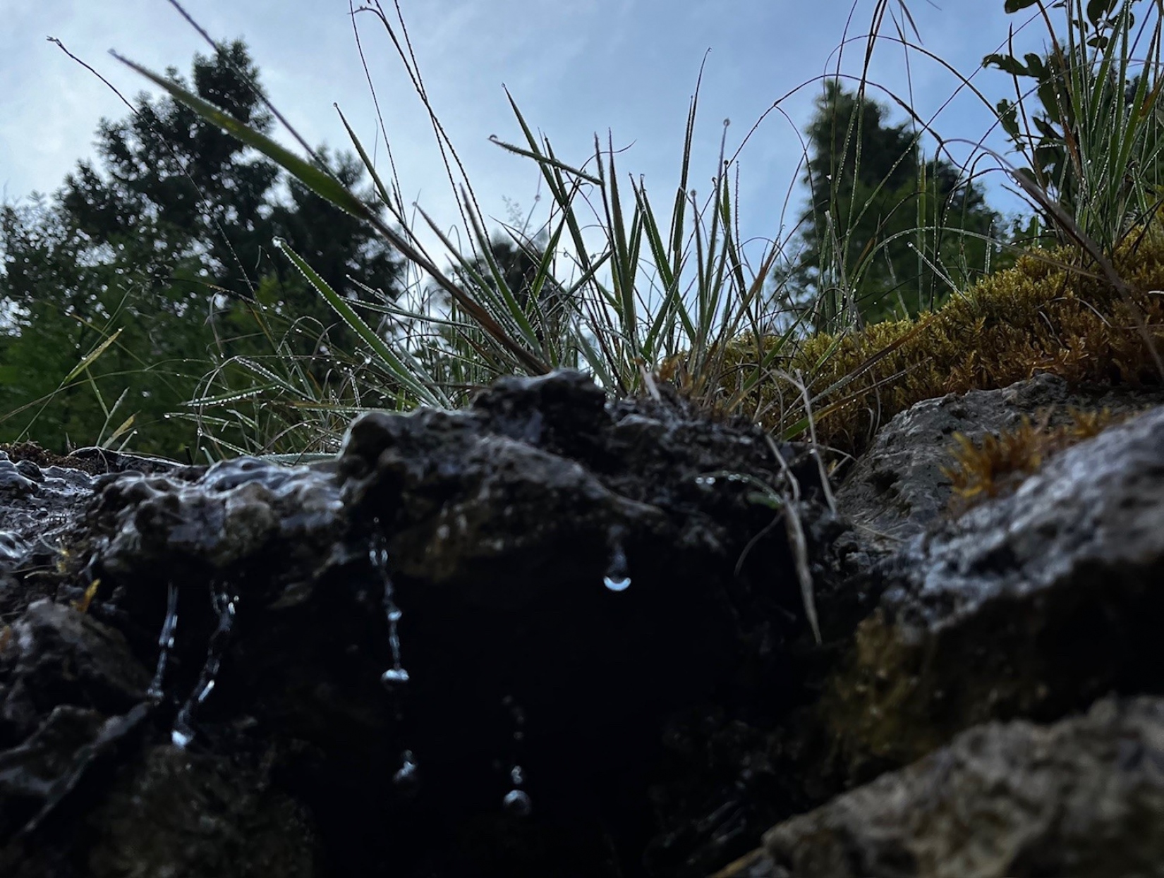
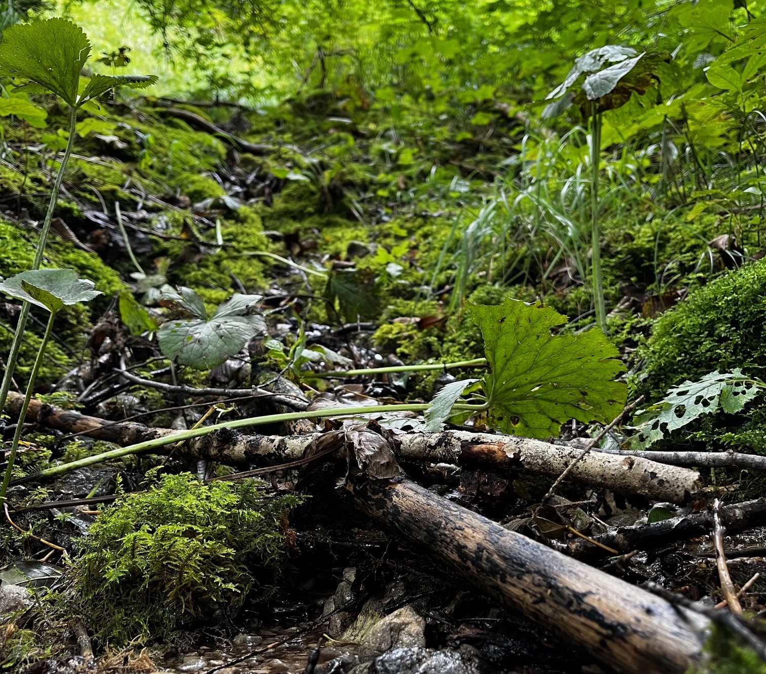
Spring habitats in the Großes Walsertal Biosphere Reserve
In view of increasing extreme weather events, including periods of drought and consequent water shortages, the protection and knowledge of springs in the Großes Walsertal Biosphere Reserve is becoming increasingly important. In addition to their essential role in water supply, springs are often small but very important habitats for endangered organisms. The pressure to utilise and develop existing springs has increased significantly due to climate change. In order to raise awareness of these special habitats and obtain an overview of the existing spring habitats in the valley, the KLAR! Biosphärenpark Großes Walsertal is launching a citizen science project in cooperation with Life Science AG.
As an introduction, an online workshop will take place on 18 February 2025 from 19:00 to 20:30. Participants will gain exciting insights into the hidden world of springs, their ecological value for highly specialised species and the importance of certain organisms as indicators of water quality. They will also be shown how climate change and increasing utilisation pressure are affecting these sensitive habitats. Finally, the methodology of spring mapping will be presented and a typical mapping day outlined. After the workshop, interested parties will have the opportunity to secure a place on the field trip in summer 2025, during which the methodology will be applied in the field.
Life Science AG has already successfully carried out a citizen science project to record spring habitats in the Black Forest biosphere area and will now transfer this project to the conditions in the Großes Walsertal. The tried-and-tested mapping and evaluation method records not only the location but also characteristics such as spring size, temperature, cultural-historical significance, flora and fauna as well as potential human influences. As an alternative to the tried-and-tested analogue recording, the Qfield app is also being adapted so that walks in the Großes Walsertal can become small research trips.
As a model region for sustainable development, the biosphere reserve bears a special responsibility for the long-term protection of natural springs. We are committed to securing the supply of drinking water and at the same time protecting the habitat for rare species. At the same time, we must ensure that the springs are utilised in the most environmentally friendly way possible to provide water for humans and animals.
If you are interested, please register in advance with our Klar! manager - Lukas Ellensohn at This email address is being protected from spambots. You need JavaScript enabled to view it.. He will send you all further details and the link to the online workshop.
This project fulfils version 1.1 of the quality criteria for citizen science projects on Österreich forscht.
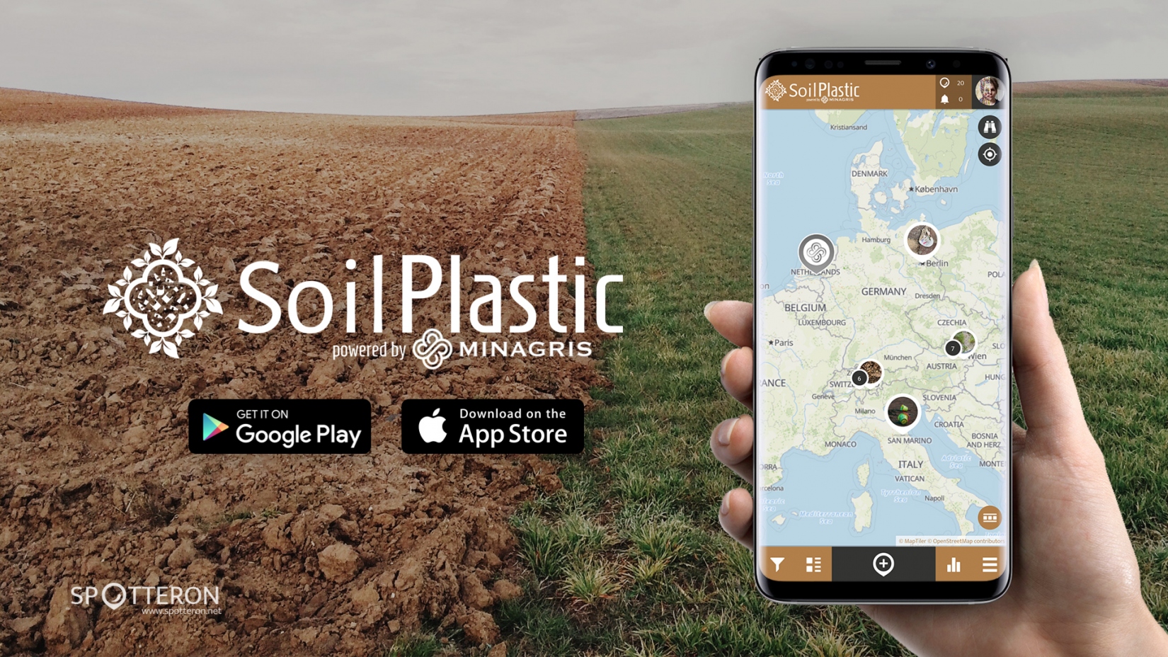
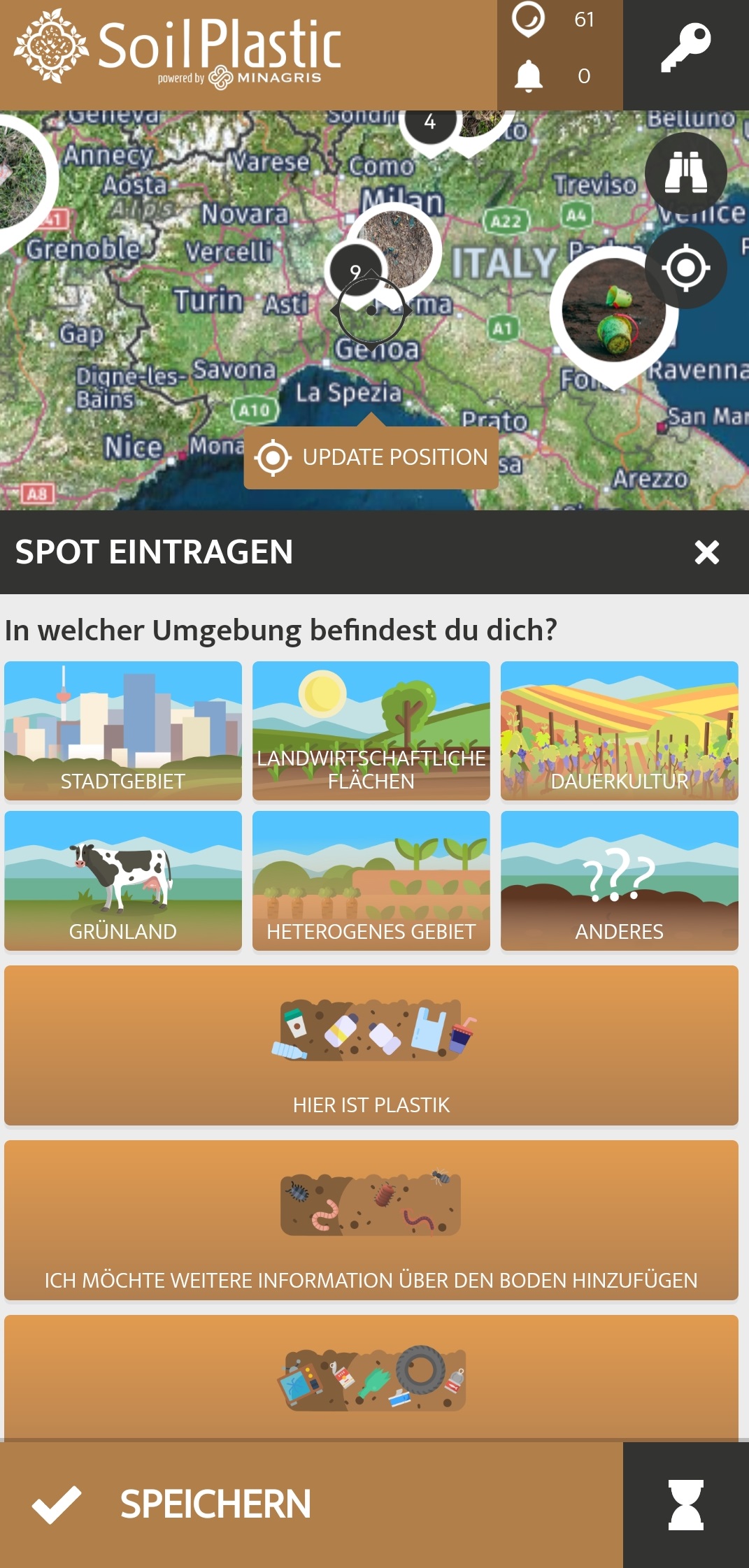
SoilPlastic
SoilPlastic is a citizen science project that collects data on plastic in soils. No prior knowledge is needed to participate and you can enter your observations in the SoilPlastic app in just a few minutes.
What is it about?
Plastic products and their remains are ubiquitous. However, we still know little about how much and which types of plastic end up in soils and what effects this has. Observations by citizen scientists help scientists to fill this knowledge gap. This is an important field of (citizen) science, as we rely on soils to produce 95% of our food.
How can you participate?
With the SoilPlastic app for Android and iOS, observations can be entered anywhere and at any time. Entries can also be made via the browser in the web-based app. So if you spot plastic in the environment while walking, cycling or on your way to work/school, enter your observation as a "spot" in the app. GPS localisation on your smartphone should be activated so that the spot is automatically placed in the right location. A spot needs at least information about the amount and size of the plastic found, about the surroundings (field, park, etc.) and a photo of your observation.
Other details are optional: colour of the plastic, type of plastic, information about the soil (texture, soil life), other material found. This will help the research team to understand the distribution of plastic and the site more precisely. Of course, the environment will be happy if you take the found objects with you and dispose of them in the correct waste bin.
What do I get out of it as a citizen scientist?
The citizen scientists become part of the EU research project MINAGRIS (Micro- and Nanoplastics in Agricultural Soils) and make an important contribution to a clean environment by adding knowledge and collecting the found objects from the environment and disposing of them properly. You will also learn new things about plastics, soil and (citizen) science in a fun way. Furthermore, the SoilPlastic app allows you to connect with other Citizen Scientsts who probably have similar interests. As the SoilPlastic app is part of the citizen science platform Spotteron, you can use the same account as in other Spotteron apps and communicate about different topics and projects.
What is the data used for?
The collected data is used in the MINAGRIS project to get an overview of the amount and type of visible plastic on soils. MINAGRIS investigates the effects of plastic on soils and biodiversity and develops a sustainable use of plastic. The spots in the SoilPlastic app are also visible to everybody interested.
Interactive map:
Links:
Zoom into Soil: Microplastics: Webinar of the British Society of Soil Science about microplastic in soils
MINAGRIS is funded by the European Union's Horizon2020 programme for research and innovation under contract number 101000407.
Picture gallery


https://www.citizen-science.at/en/component/k2/tag/geology#sigProId9c4b79d76d
Development of the app by Spotteron
![]()
SoilPlastic is part of the EU project MINAGRIS
![]()
This project fulfils version 1.1 of the quality criteria for citizen science projects on Österreich forscht.
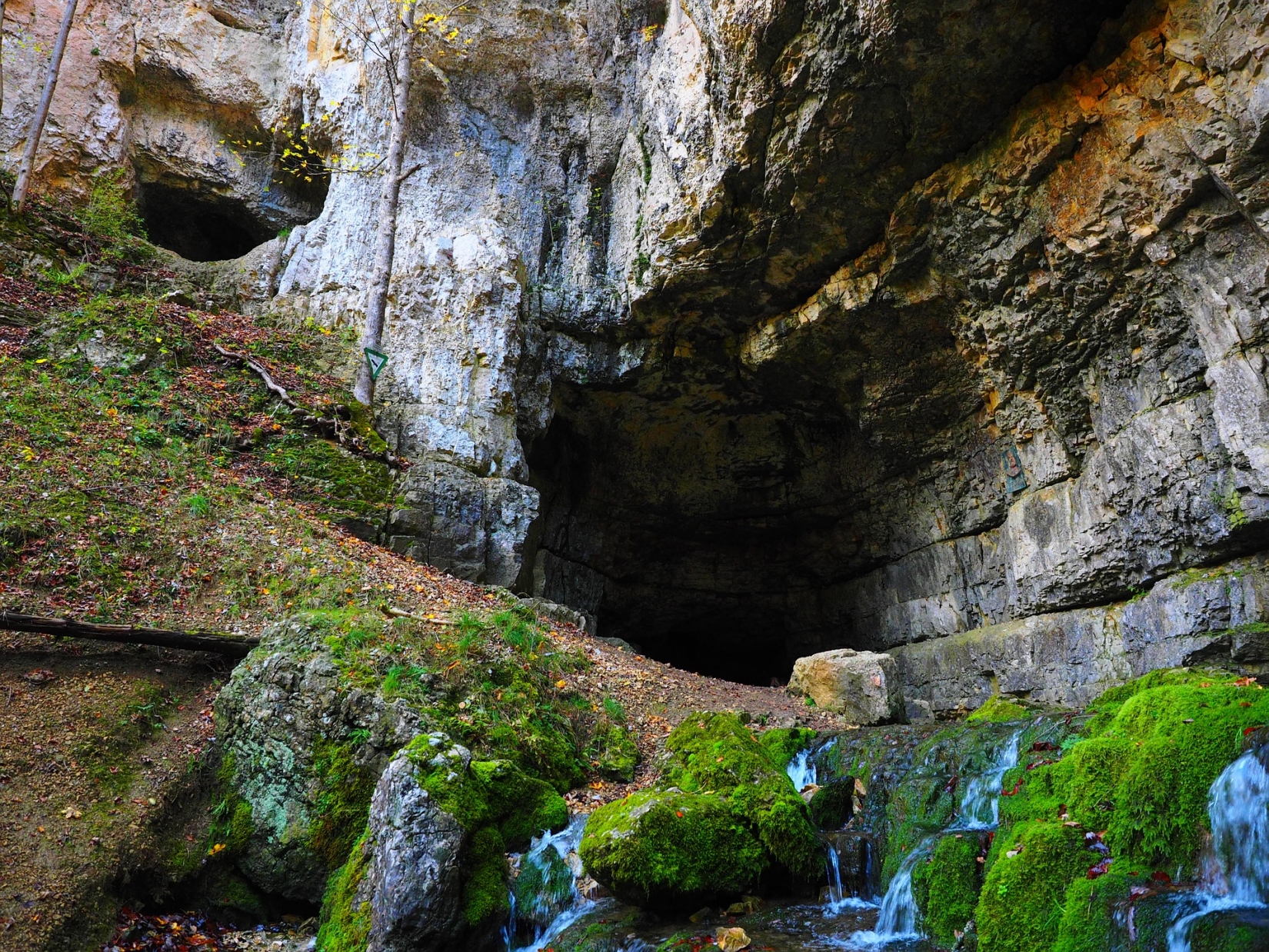
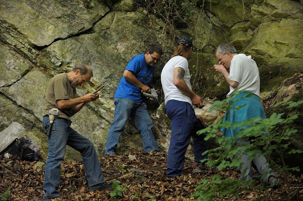
Cave documentation
Karst and cave documentation
The Working Group on Karst and Caves (KHA) of the Natural History Museum Vienna cooperates closely with the Speleologic Society in Vienna and Lower Austria, but also with other groups of the Austrian Speleological Association (VÖH). The KHA is primarily active in the eastern part of Austria. Working in the terrain requires some physical fitness, surefootedness and a sense of orientation, as marked paths are usually abandoned. However, interesting objects can be found at all altitudes and terrain forms; therefore, participation is possible at any age.
Cave entrances are searched for in the area, their position (coordinates) determined and photographed. The documentation of karst forms (dolines, karst springs, shrinkage etc.) is of interest as well. Enthusiasts have the opportunity to learn how to survey caves and how to draw cave maps!
Who can participate?
Interested people aged 14 and over who like to walk off the beaten track. No new Citizen Scientists are currently being sought - participation in the project is therefore closed.
Period
A participation is possible right away; the end of the project is not foreseeable.
Where?
Primarily in Eastern Austria, but also throughout Austria.
What kind of data is collected?
Determination of the coordinates of cave entrances and karst forms (by means of GPS, laser scan, aerial photographs, etc.)
Photodocumentation of karst forms and caves
Mapping and surveying of caves after previous training possible
Roles in the project
Project management: Overall coordination of the project
Project coordination: Data management
Project participants (Citizen Scientists): data collection and processing
Contact
Click here to go to the website of the Speleological Society of Vienna and Lower Austria.
If you are interested and have found something or would like to make an appointment, please contact us by phone or e-mail:
Mag Dr. Lukas Plan
This email address is being protected from spambots. You need JavaScript enabled to view it.
Tel.Nr.: +43 1 5230418-10
Dipl.-Geogr. Pauline Oberender
This email address is being protected from spambots. You need JavaScript enabled to view it.
Tel.Nr.: +43 1 5230418-14
This project fulfils version 1.1 of the quality criteria for citizen science projects on Österreich forscht.
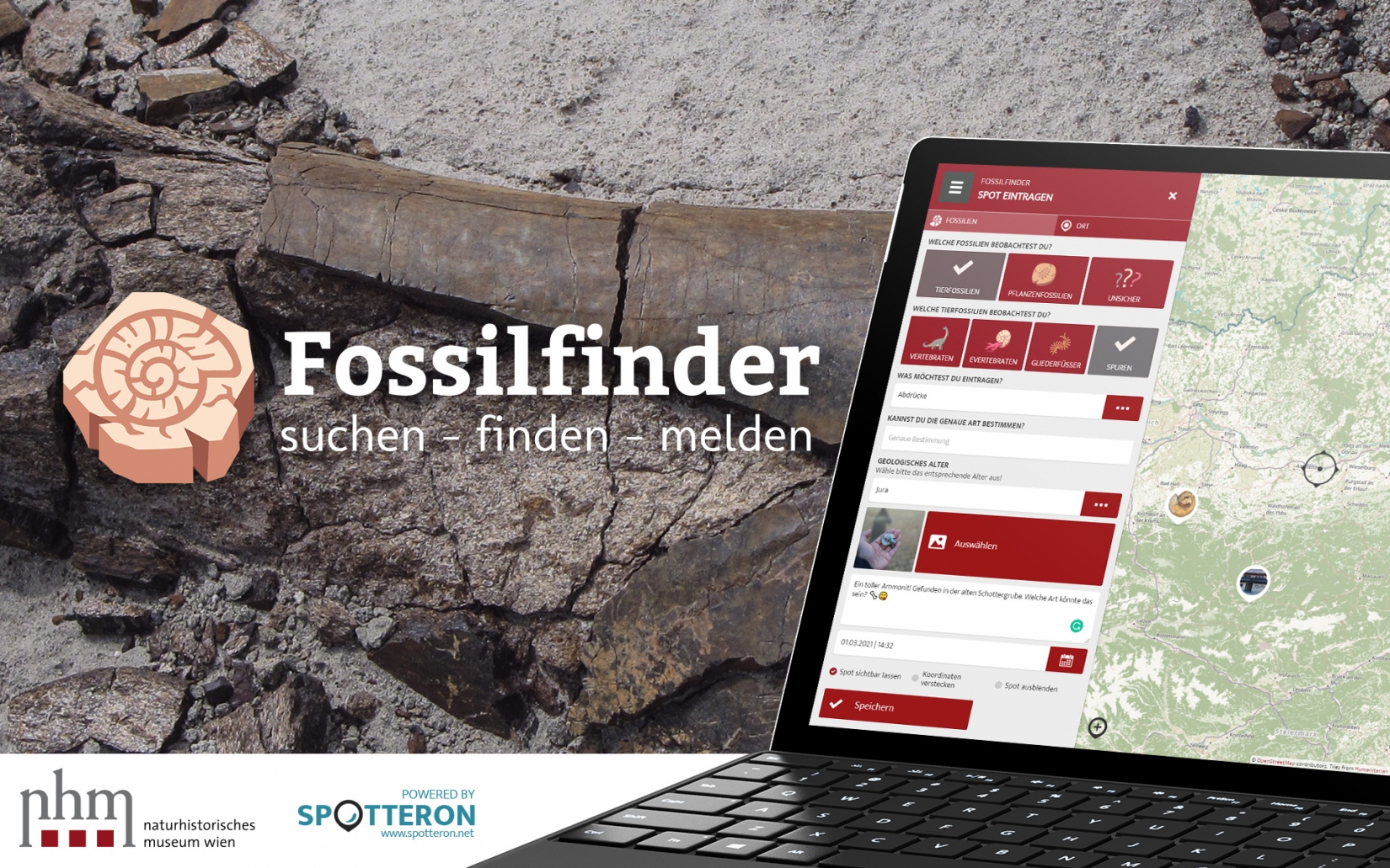
Fossilfinder
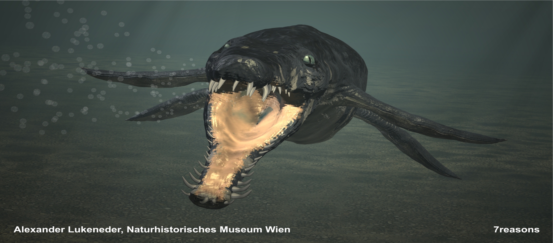
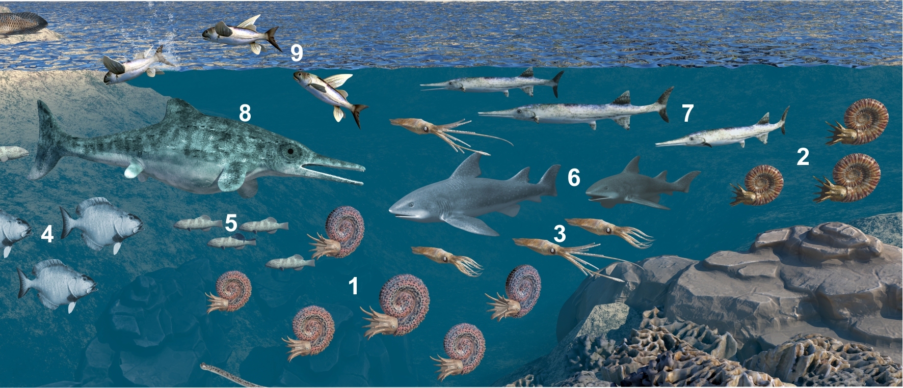
Due to the enormous request and the multitude of consignments of fossil images encompassing almost the entire Earth history, the precise issues and the resulting project target were adapted in accordance to the requirements and wishes oft he citizen scientists. The geographical and chronological distribution of fossils in Austria is a particular focal point in the scientific problem of this geoscience project. Exciting field research in the Austrian Alps forms the foundation of the resulting research. Effective explorations in Austria are continuously declining, but knowledge about fossils is always increasing. This gap can be closed with the combined energy of both young and old, from scientists to citizen scientists. Methods from biostratigraphy and taxonomy are used, as are the latest techniques in photographic documentation. The relative age of ammonites, molluscs and snails are identified, which then allows basic classification in taxonomic groups. These methods and goals then lead to more complete data on the distribution of various fossil groups in Austria. Scientists then benefit from knowing about sources for different fossil groups in new locations and citizen scientists benefit from precise identification by specialists.
Here you can also find the Young Science contact for interested schools and teachers.
This new project gives interested citizen scientists, who range from school pupils to amateur collectors and professional scientists, a basis for identifying new fossil findings, publishing these and thereby completing the network of data from the Earth history in Austria. The collaborators are thus collecting new data for research into the Earth history of the Alps in particular but also of Austria in general. This can be through photo documentation or by actively collecting Cretaceous fossils. Another very useful dimension to this project is the treasures kept in private collections belonging to many citizen scientists. These discoveries are entered into accessible data sets and inventory databases and should result in a comprehensive picture of deposits formed during the Earth history and its fossils in Austria. The data is evaluated, made available as a graphic online and shown on the Fossilfinder APP. The aim of this is to then create an interactive map showing the geographic distribution of these discoveries. The new project enables a correlation with other places of discovery from the same era and fossil associations in Europe.
The tasks within the project are supported individually. The project manager is, on the one hand, responsible for coordinating and creating data sets and processing the information into publications and databases that can be accessed and viewed by any interested party, whether scientists, collectors, amateur researchers or citizen scientists. The areas of responsibility for citizen scientists mean that the volunteers in the project are allocated a variety of tasks. These range from collecting finds and reporting them to the joint potential description to the final inventory and publication of the fauna and flora in Austria’s Earth history.
There will soon be a link to the data and the accompanying results on the project page on Österreich forscht. This will also provide a detailed description of where and how you can find and utilise the project data.
Those who are interested in taking part should contact Dr Alexander Lukeneder via e-mail (This email address is being protected from spambots. You need JavaScript enabled to view it.) or telephone (0043 1 52177 251).
Podcast episode
If you would like to learn more, you can listen to the Wissen macht Leute podcast episode about the project (in German).
Contribute fossil findings in the interactive map
App: SPOTTERON Citizen Science Plattform
Open interactive map in full screen
Image gallery
Click on an image to enlarge.
Citizen Scientists
-
 Citizen Scientist Vinzenz Loimayr, Vinzenz Loimayr Citizen Scientist Vinzenz Loimayr, Vinzenz Loimayr
 - Citizen Scientist Alfred Leiblfinger, Dominik Kaluza Citizen Scientist Alfred Leiblfinger, Dominik Kaluza
- Citizen Scientist Andrea Beran, Andrea Beran Citizen Scientist Andrea Beran, Andrea Beran
- Citizen Scientist Andreas Bonanni, Alexander Lukeneder Citizen Scientist Andreas Bonanni, Alexander Lukeneder
- Citizen Scientist Anton Englert, Alexander Lukeneder Citizen Scientist Anton Englert, Alexander Lukeneder
- Citizen Scientist Bertold Lumplecker, Hubert Putz Citizen Scientist Bertold Lumplecker, Hubert Putz
-
- Citizen Scientist Eva Hasenzagel, Eva Hasenzagel Citizen Scientist Eva Hasenzagel, Eva Hasenzagel
- Citizen Scientist Ferdinand Estermann, Florian Hummer Citizen Scientist Ferdinand Estermann, Florian Hummer
- Citizen Scientist Franz Mayer, Liane Mayer Citizen Scientist Franz Mayer, Liane Mayer
- Citizen Scientist Franz Topka, Alexander Lukeneder Citizen Scientist Franz Topka, Alexander Lukeneder
- Citizen Scientist Gerhard Wanzenböck, Werner Kerndler Citizen Scientist Gerhard Wanzenböck, Werner Kerndler
-
- Citizen Scientist Horst Kühschelm, Horst Kühschelm Citizen Scientist Horst Kühschelm, Horst Kühschelm
- Citizen Scientist Justine Uprimny, Alexander Lukeneder Citizen Scientist Justine Uprimny, Alexander Lukeneder
-
- Citizen Scientist Martin Maslo, Alexander Lukeneder Citizen Scientist Martin Maslo, Alexander Lukeneder
- Citizen Scientist Oliver Schmitsberger, Martin Penz Citizen Scientist Oliver Schmitsberger, Martin Penz
- Citizen Scientist Peter Skoumal, Marlene Skoumal Citizen Scientist Peter Skoumal, Marlene Skoumal
- Citizen Scientist Petra Lukeneder, Alexander Lukeneder Citizen Scientist Petra Lukeneder, Alexander Lukeneder
- Citizen Scientist Reinhard Polak, Reinhard Polak Citizen Scientist Reinhard Polak, Reinhard Polak
-
- Citizen Scientist Umberto Uprimny, Alexander Lukeneder Citizen Scientist Umberto Uprimny, Alexander Lukeneder
- Citizen Scientist Wolfgang Maherndl, Johanna Maherndl Citizen Scientist Wolfgang Maherndl, Johanna Maherndl
-
- Citizen Scientists Karl Bösendorfer, Alexander Lukeneder Citizen Scientists Karl Bösendorfer, Alexander Lukeneder
- Citizen Scientist Harald Spitznagel, Claudia Spitznagel Citizen Scientist Harald Spitznagel, Claudia Spitznagel
- Tristan Tuncay Riedl Tristan Tuncay Riedl
- Young Scientist Lisa Marie Lukeneder, Alexander Lukeneder Young Scientist Lisa Marie Lukeneder, Alexander Lukeneder
- Lisa Petracs Lisa Petracs


https://www.citizen-science.at/en/component/k2/tag/geology#sigProId8f431b06ad
Fossils


https://www.citizen-science.at/en/component/k2/tag/geology#sigProIdd216b2b21f
Publications with participation of citizen scientist
Lukeneder, A., Surmik, D., Gorzelak, P. et al. Bromalites from the Upper Triassic Polzberg section (Austria); insights into trophic interactions and food chains of the Polzberg palaeobiota. Scientific Reports 10, 20545 (2020)
Involved citizen scientists: Birgitt Aschauer and Karl Aschauer
Type of participation: collecting fossils, donating specimens to science
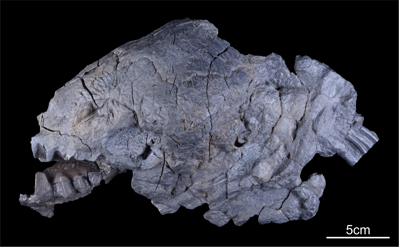
Lukeneder, A., Zverkov, N. 2020. First evidence of a conical-toothed pliosaurid (Reptilia, Sauropterygia) in the Hauterivian of the Northern Calcareous Alps, Austria. Cretaceous Research 106, February 2020, 104248
Involved citizen scientists: Karl Bösendorfer
Type of participation: reporting the locality, collecting fossils
Lukeneder, A. 2018. A new ammonoid fauna from the Northern Calcareous Alps (upper Hauterivian–lower Barremian, Austria). Cretaceous Research, 88, 158-172.
Involved citizen scientists: Karl Bösendorfer
Type of participation: collecting fossils, donating specimens to science
Picture: (c) Alexander Lukeneder
Lukeneder, A., Lukeneder, P. 2022. Taphonomic history and trophic interactions of an ammonoid fauna from the Upper Triassic Polzberg palaeobiota. Scientific Reports, 12, 7455.
Involved citizen scientists: Birgitt and Karl Aschauer
Type of participation: donating specimens to science
Picture: (c) Alexander and Petra Lukeneder
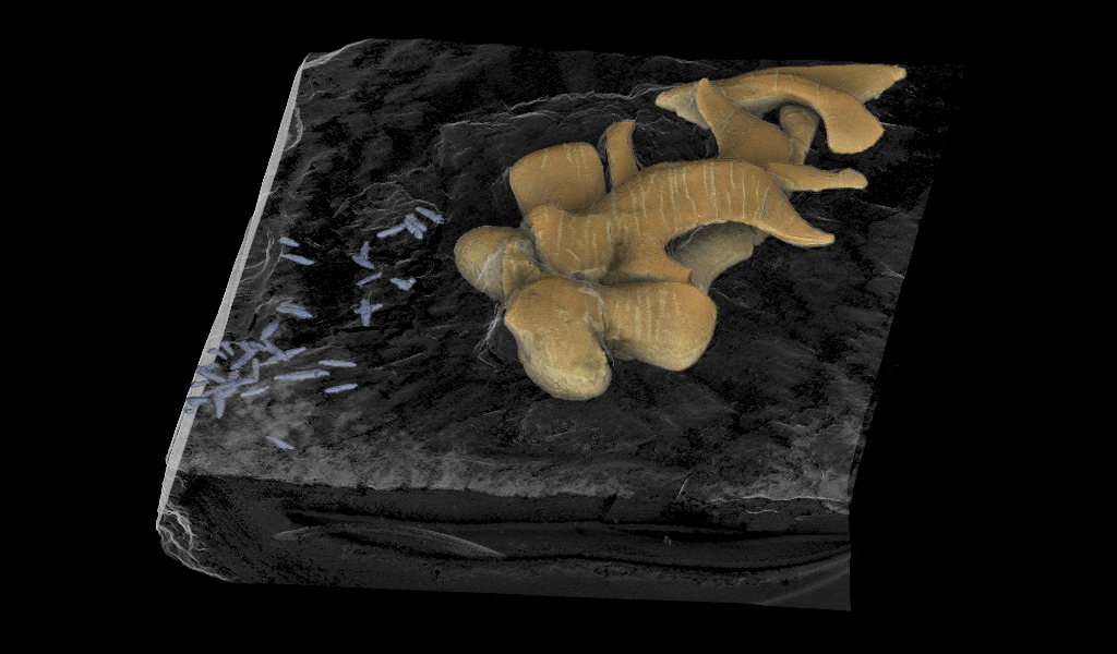
Lukeneder, P., Lukeneder A. 2022. Mineralized coleoid cranial cartilage from the Late Triassic Polzberg Konservat-Lagerstätte (Austria)". PLOS ONE, 17(4): e0264595.
Involved citizen scienctist: Birgitt and Karl Aschauer
Types of participation: donating specimens to science
Picture: (c) Alexander Lukender, 7reasons
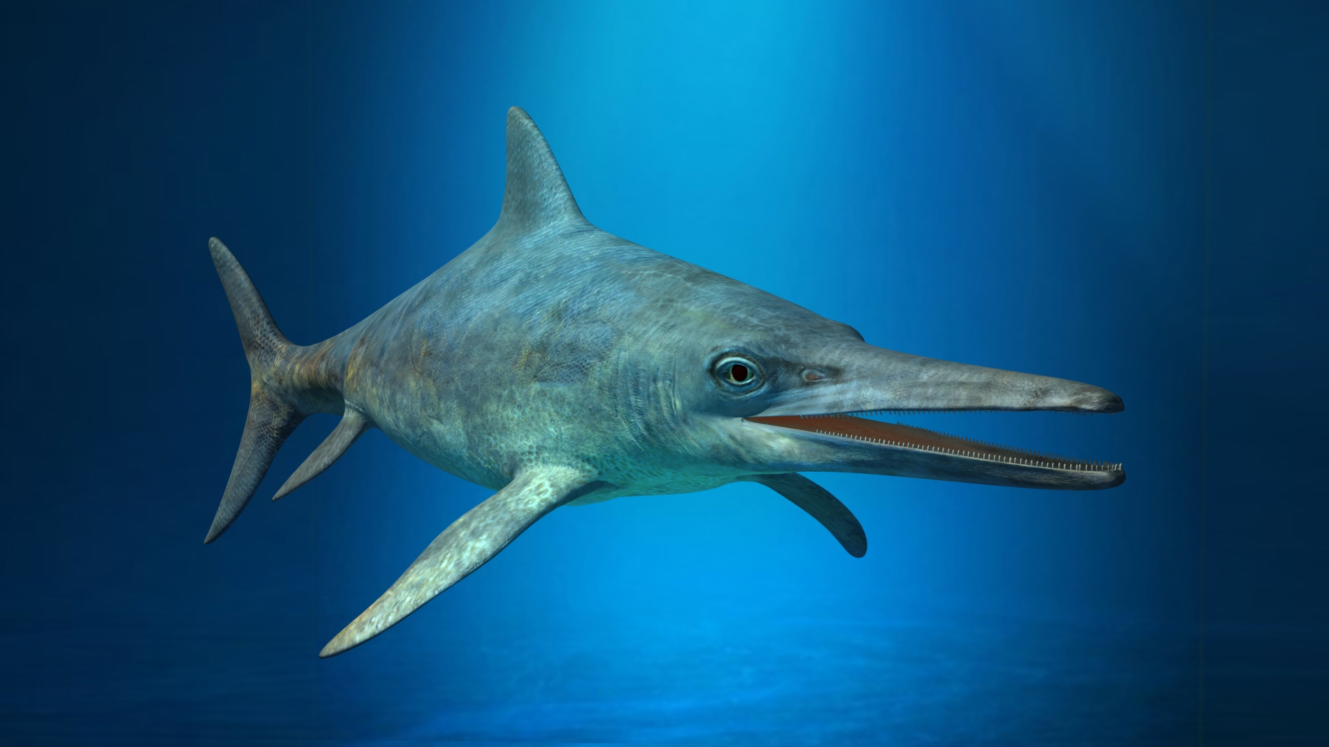
Lukeneder, A., Zverkov, N., Kaurin, C., Blüml, V. 2022. First Early Cretaceous ichthyosaurs of Austria and the problem of Jurassic–Cretaceous ichthyosaurian faunal turnover. Cretaceous Research, 136, 2022, 105224.
Involved citizen scientists: Karl Bösendorfer, Alfred Leiflfinger
Type of participation: collecting fossils, donating specimens to science
Picture: (c) Lukeneder, NHMW
Lukeneder, A., Lukeneder P. 2021. The Upper Triassic Polzberg palaeobiota from a marine Konservat-Lagerstätte deposited during the Carnian Pluvial Episode in Austria. Nature Research, Scientific Reports, 11, 16644 (2021).
Involved citizen scientists: Birgitt and Karl Aschauer
Types of participation: donating specimens to science
Interesting links
In the following you will find interesting internet links with Cretaceous period reference. On these pages citizen scientists can read the latest publications about fossils, environment or climate variations of the Cretaceous period. In addition, internationally and globally valid classifications and zonings of the Cretaceous can be viewed. Important data and facts for route planning and the localization of find points can be planned and retrieved in digital systems. Tectonic units and rock formations can be explored on geological maps.
All these data are freely accessible on the assigned links.
https://www.journals.elsevier.com/cretaceous-research
https://www.journals.elsevier.com/palaeogeography-palaeoclimatology-palaeoecology
http://www.austrianmap.at/amap/
https://www.kompass.de/wanderkarte/
https://www.geologie.ac.at/onlineshop/karten
https://fossils-of-austria.at/
Media
Citizen Science Seminar
In 2022, poject coordinator Alexander Lukeneder held a lecture about Fossilfinder as part of the lecture series "Citizen Science Seminar" at the University of Natural Resources and Life Sciences Vienna (BOKU): "Fossilfinder - to report or not to report, that is the question" (in German). Here, you can watch the video recording of the lecture on our YouTube-channel:
Pliosaurs in the Cretaceous Sea of Austria (in German)
Research in the Dolomites (in German)
Animation of the heteromorphours Cretaceous ammonite Dissimilites
Ammonite mass occurrences in Turkey
Science Talk - Mass extinction, swamp forests and flying fish of Lunz
First ichthyosaur record from the Cretaceous period in Austria
This project fulfils version 1.1 of the quality criteria for citizen science projects on Österreich forscht.
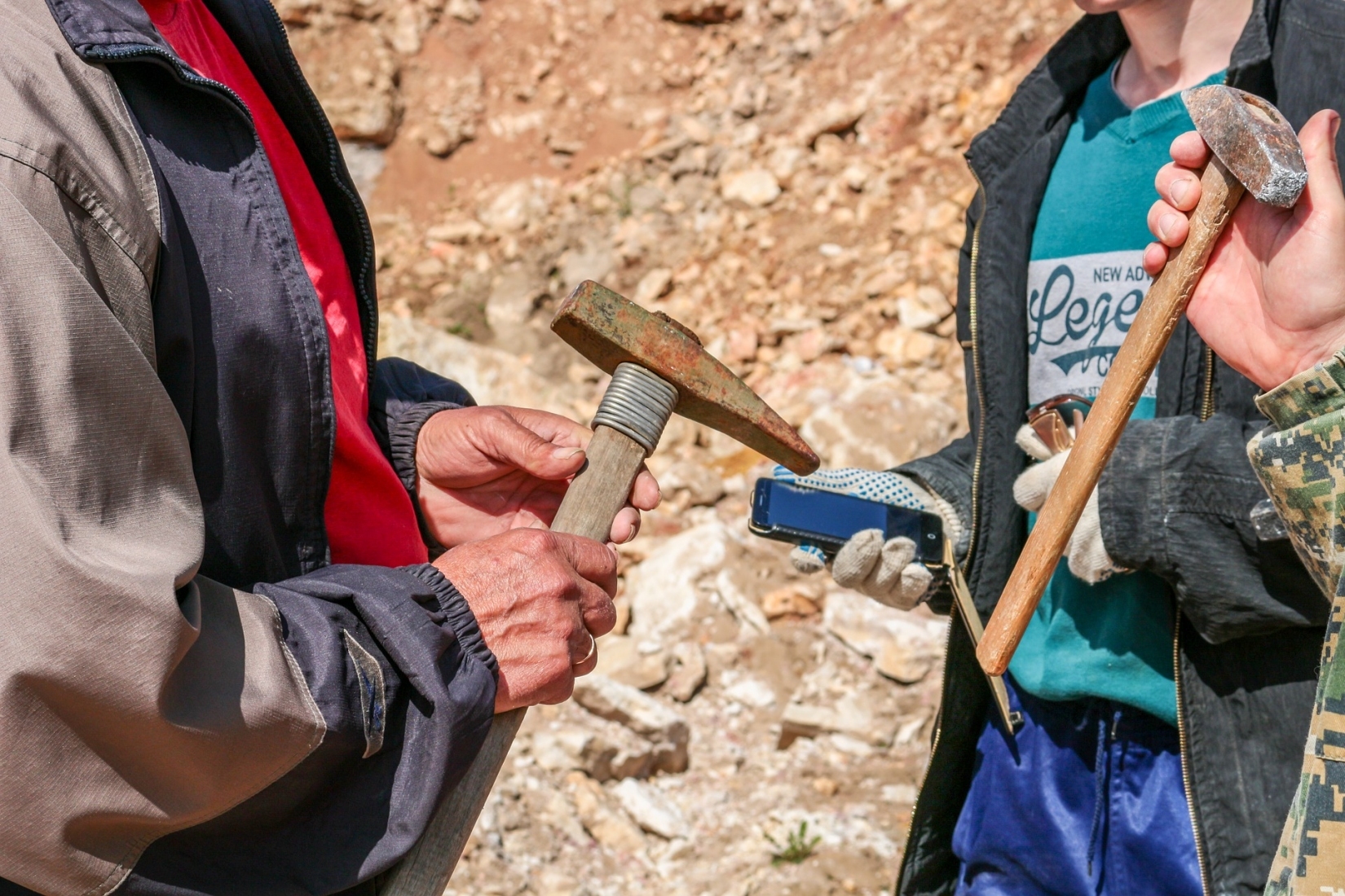
Mineral deposits in Austria
Austria is rich in a wide range of mineral deposits. Precise documentation of both “old” deposits (e.g. mining heaps and tunnels, slag heaps) and “new” location spots (e.g. quarries, natural outcrops, road cuts, etc.) is one of the focuses of the Department of Mineralogy and Petrography at the Natural History Museum Vienna. This can be achieved only with the help of mineral collectors, amateur mineralogists and members of the general public interested in mineralogy who collect minerals and make them available to scientific experiments. The outstanding collaboration with collectors with regard to documenting mineralogy in Lower Austria (“NÖ mineral database”) and Vorarlberg should be expanded to other federal states. Tyrol in particular is still relatively unexplored in comparison to other federal states.
© Harald Schillhammer
Who can participate?
Mineral collectors, amateur mineralogists and members of the general public who are interested in mineralogy.
Time period
The project is running for an unspecified period.
Where?
Across all of Austria (especially Tyrol).
What data is needed?
Citizen scientists can support research by collecting minerals and documenting mineral discoveries, as well as providing samples for mineralogical analyses. The results of scientific analyses will usually be published in popular scientific publications (in German) (e.g. as “Neue Mineralfunde aus Österreich” [New minerals found in Austria] in the journal “Carinthia II” or, more rarely, in the journals “Der Steirische Mineralog”, “Der Aufschluss”, “Mineralien-Welt” or “Lapis”), whereby the project manager sends the final article to all participants in PDF format. Articles in “Carinthia II” generally become open access one year after publication, which means that anyone can download them for free.
Shortly after publication, the project manager will enter the new mineral analyses in all publications, together with meaningful photos, into freely accessible international mineral and mineral location databases, such as Mindat (in English) and Mineralienatlas - Fossilienatlas (in German).
The publications are often written in co-authorship with the finder, especially if they provided important information through good documentation of the discovery and circumstances of finding, or through research into literature in archives and by surveying residents at the location.
Exceptional scientific results will also be published in international, English-language scientific journals.
Examples of popular science publications from recent years are:
- Journal "Carinthia II": Neue Mineralfunde aus Österreich LXV (2016) [PDF]
- Journal "Carinthia II": Neue Mineralfunde aus Österreich LXVI (2017) [PDF]
- Die Mineralogie der weltweit einzigartigen Schlacken von Waitschach, Kärnten [The mineralogy of globally unique slag from Waitschach, Carinthia] [PDF]
- Kolitsch, U. & Slama, M. (2016): Zur Mineralogie des niederösterreichischen Anteils des Semmering-Basistunnels: ein erster Bericht. [Mineralogy of the Lower Austrian part of the Semmering Base Tunnel: a first report] Der Steirische Mineralog 31, 20-27. [PDF on e-mail request]
- several individual contributions in: Walter, F., Auer, C., Bernhard, F., Bojar, H.-P., Brandstätter, F., Grill, J. A., Kiseljak, R., Knobloch, G., Kolitsch, U., Lamatsch, P., Lenz, C., Löffler, E., Melcher, F., Postl, W., Prasnik, H., Rausch, L., Reicht, M., Schachinger, T., Schillhammer, H., Schreieck, E., Schwabl, S., Steck, C., Steiner, T., Trattner, W. & Weißensteiner, G. (2020): Neue Mineralfunde aus Österreich LXIX. Carinthia II, 210./130., 153-218. [PDF]
How can I take part?
If you are interested and/or want to take part, please contact:
Priv.-Doz. Dr. Uwe Kolitsch
This email address is being protected from spambots. You need JavaScript enabled to view it.
This project fulfils version 1.1 of the quality criteria for citizen science projects on Österreich forscht.