1040 Wien
City Layers
Citizen Mapping as a Practice of City-Making
The project “City Layers: Citizen Mapping as a Practice of City-Making”, funded by the Austrian Science Fund (FWF) introduces a contemporary framework for city-mapping which centres on citizen experience of urban space as an integrative way to contribute to more egalitarian city design. Within the frame of the Citizen Science Award 2023, the City Layers app has been developed in collaboration with students, citizens and researchers all interested in democratising and diversifying how cities are formed.
Hypotheses
The research hypothesises that current data collection methods have prioritised simulated and measurable data, alienating and excluding diverse data sets. City Layers utilises innovative and contemporary data collection methods which allow for the recording of subjective experiences of the city. The project thus proposes a more inclusive and adaptable form of collecting information for urban design, whether it be material or immaterial, based on terms dictated by citizens.
Objectives
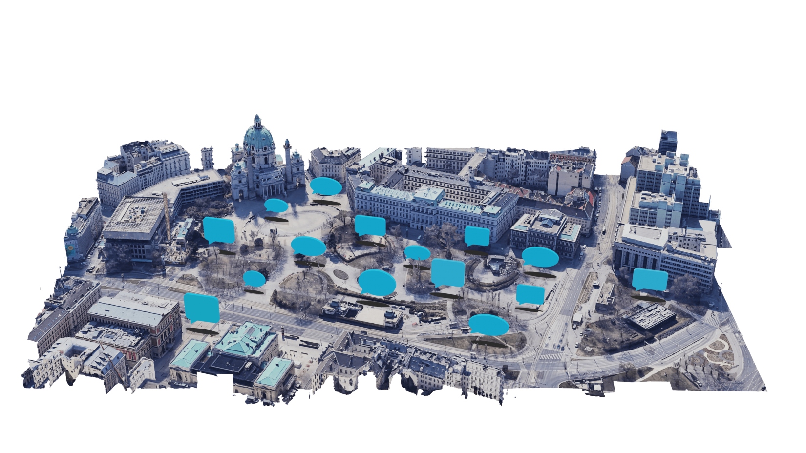
The research aims to deepen the engagement between citizens and urban design using the City Layers app by inviting them to identify, record and reflect upon a range of different material and immaterial ‘layers’ of their cities. These include accessibility, noise, safety, climate resilience, aesthetics, amenities and many more. This city mapping app serves as a means of communication between cities and their citizens, generating a contemporary, critical form of data that is collectively generated, managed and cared for.
Approach and methods
Through City Layers – a digitised participatory tool for urban design – citizens are invited to use tags, textual comments, photographs, suggestions and votes to articulate their views on a particular urban surrounding. By recognising and voicing their subjective experiences in specific spaces, citizens procure meaning and values, but also provide valuable data on how these spaces can be improved. Citizens can add thoughts on how urban places can be improved, or they can immerse themselves in the information about their urban surroundings mapped by others. Citizens' contributions are made available online as a form of commons for active use. This innovative mapping tool thus aims to reorganise individual observations into collective knowledge and brings out the strengths of citizen participation in urban design. The collected data is intended to enable a basis for a better dialogue between citizens and urban planners. Therefore, the research recognises the citizen science approach as a democratic and urgent strategy for identifying the essential components which constitute a city.
Picture Gallery
-
 © Lovro Koncar-Gamulin © Lovro Koncar-Gamulin
 - © Lovro Koncar-Gamulin © Lovro Koncar-Gamulin
- © Lovro Koncar-Gamulin © Lovro Koncar-Gamulin
- © Lovro Koncar-Gamulin © Lovro Koncar-Gamulin
- © Lovro Koncar-Gamulin © Lovro Koncar-Gamulin


https://www.citizen-science.at/en/projects/city-layers-1047#sigProId5975b3fb95
![]()
This project fulfils version 1.1 of the quality criteria for citizen science projects on Österreich forscht.
- politics
- health
- culture